Lawa i gejzery – Lava and geysers

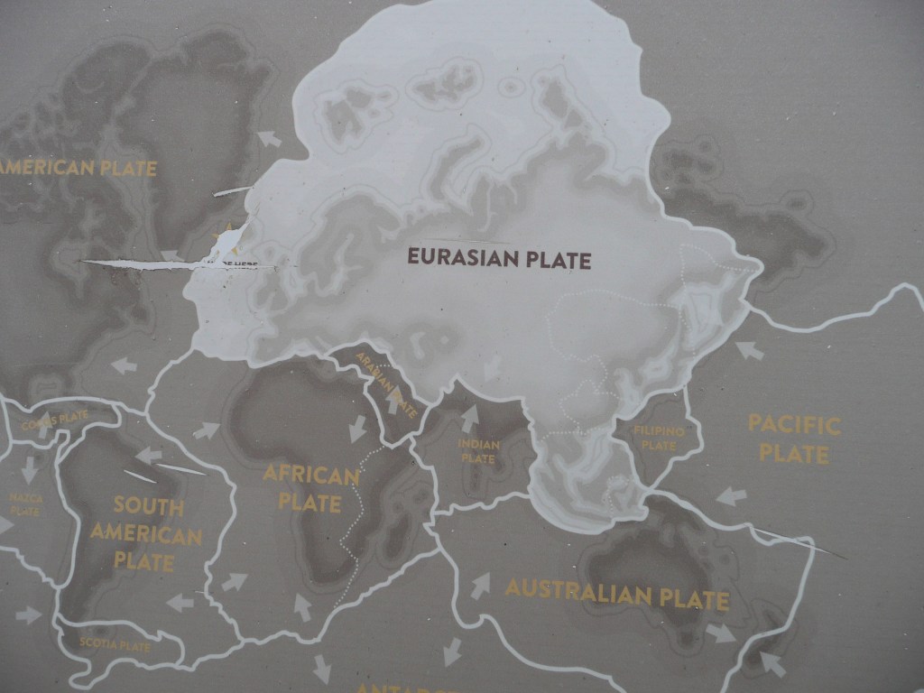
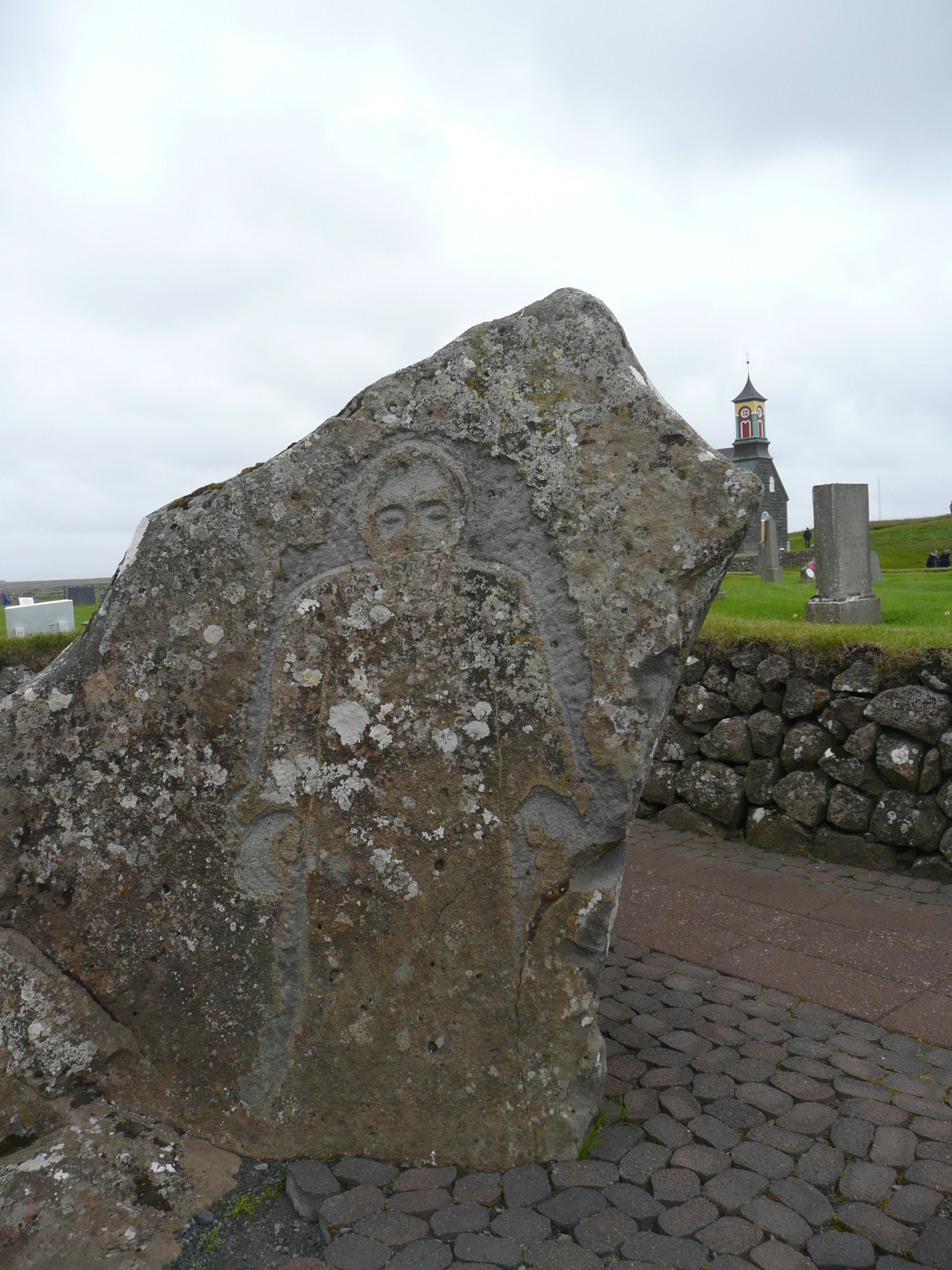
Południowa część Islandii to labirynt skał magmowych i gorących gejzerów, ale też wielkie pola lawy zastygłej w malownicze pagórki. Ta część wyspy może doświadczać pięćdziesiąt tysięcy trzęsień ziemi w ciągu trzech tygodni! Olbrzymy pod ziemią nigdy nie zasypiają…

The southern part of Iceland is a labyrinth of igneous rocks and hot geysers, but also vast lava fields that have hardened into picturesque hills. This part of the island can experience fifty thousand earthquakes in three weeks! The giants underground never sleep…

Południowa Islandia / Southern Iceland

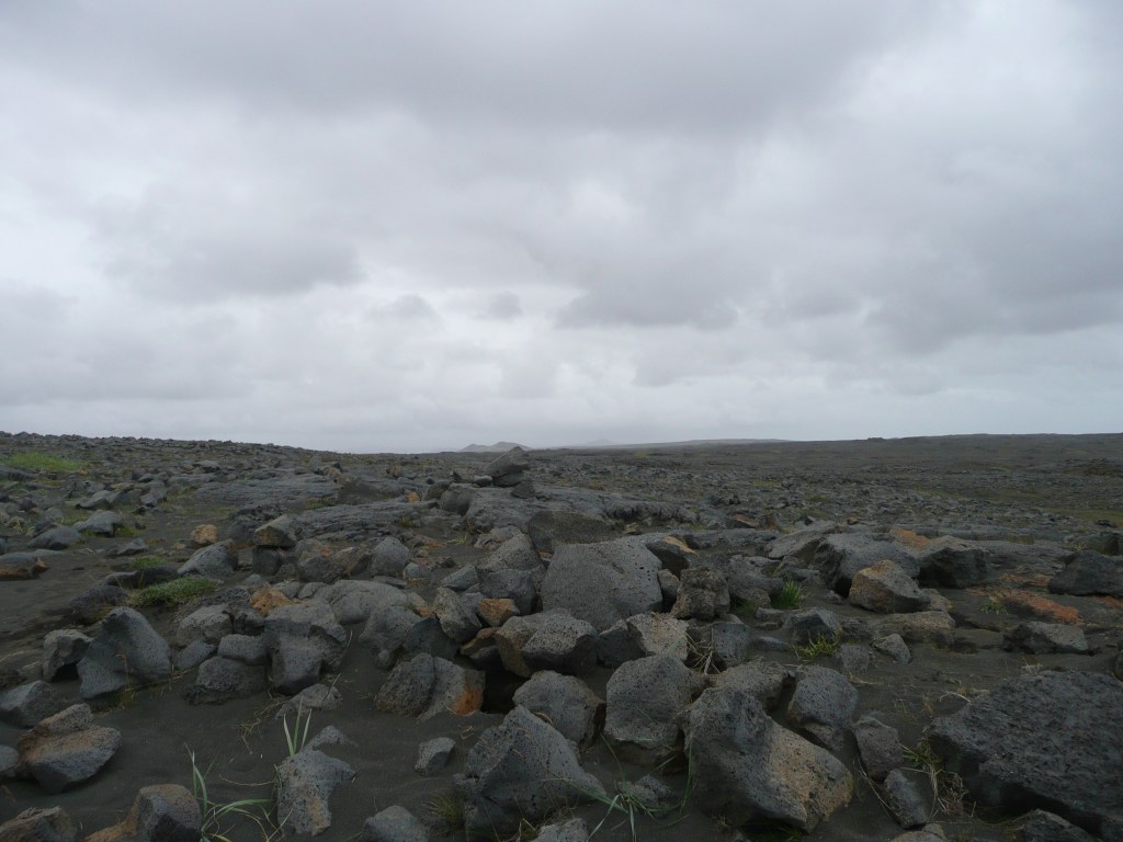
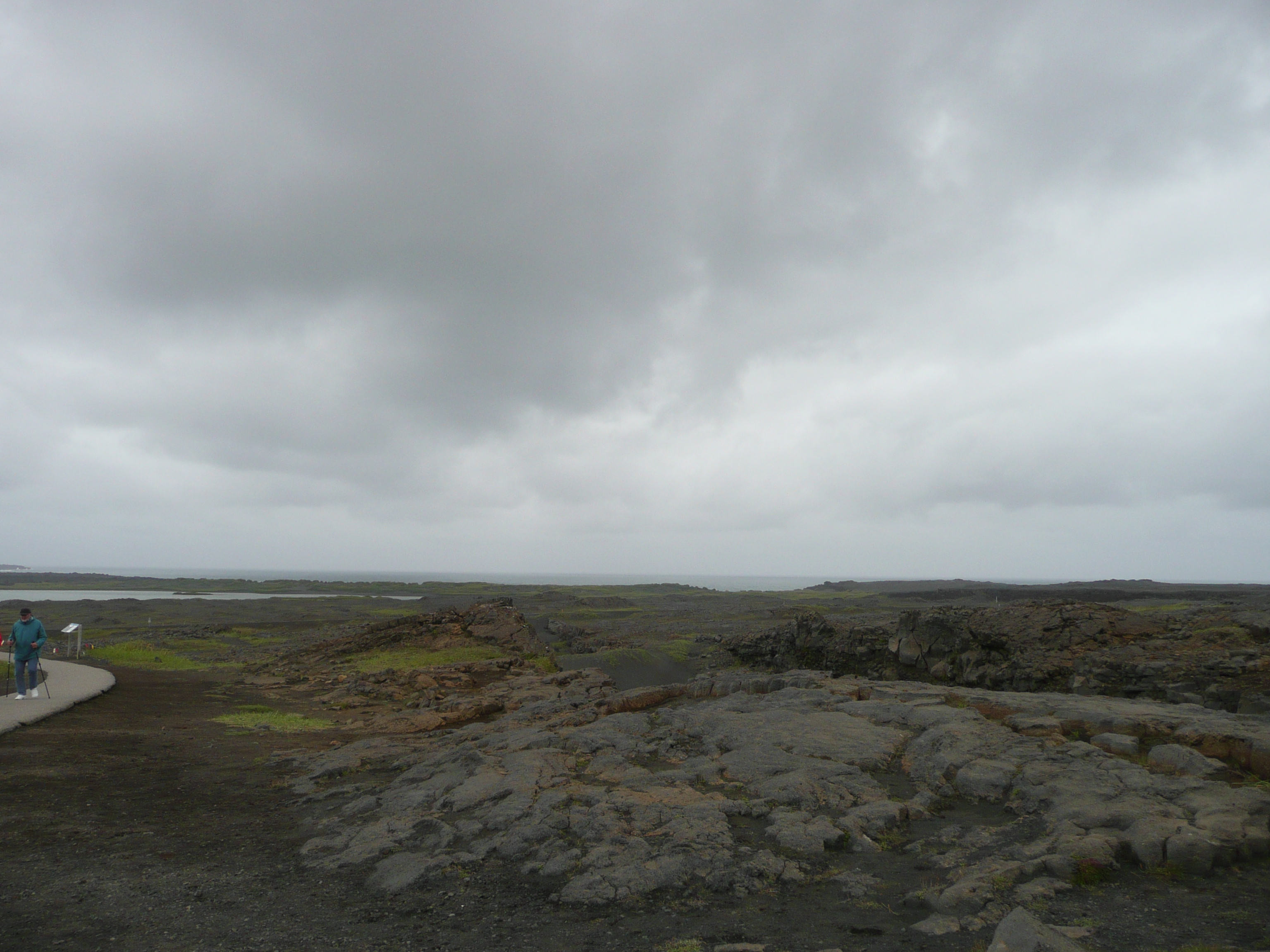
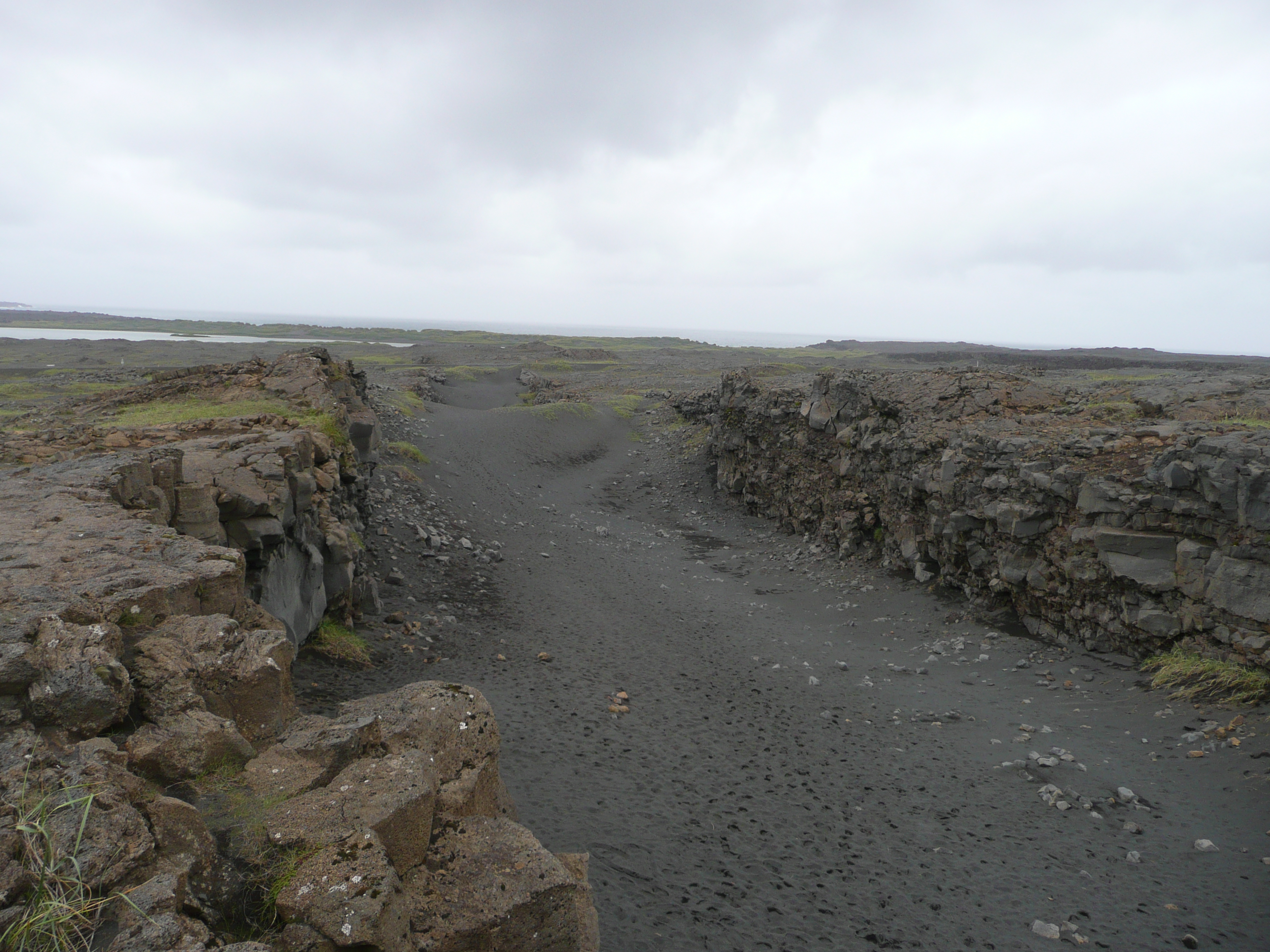
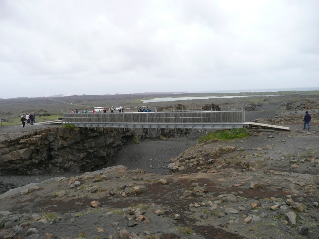
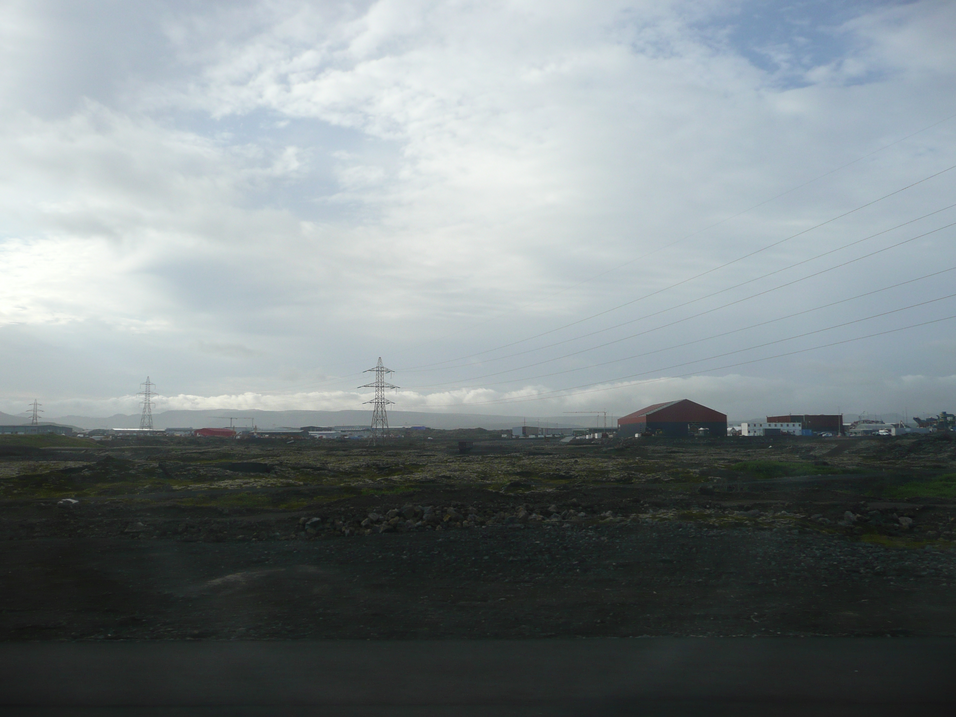
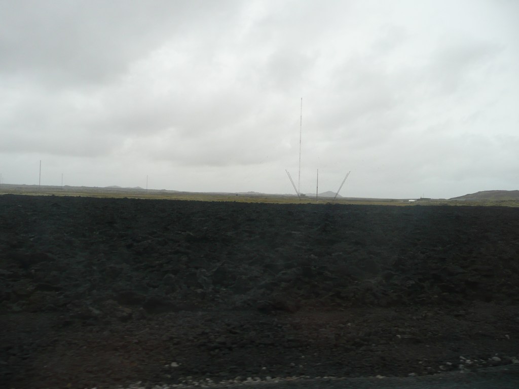
Jedziemy wśród czarnego krajobrazu niedawno wystygłej lawy niedaleko miasteczka Grindavik. Od 2021 roku, kiedy erupcja wulkanu w tym rejonie trwała prawie trzy miesiące, rejon doświadcza wzmożonej aktywności sejsmicznej. Erupcja w 2023 roku była coraz bliżej miasteczka, a 14 stycznia 2024 lawa pojawiła się niespełna kilkaset metrów od niego. Spaliły się trzy domy, a lawa i trzęsienie ziemi poważnie uszkodziły infrastrukturę. Tak to wygląda półtora roku po tych wydarzeniach:

We’re driving through a black landscape of recently cooled lava near the town of Grindavik. Since 2021, when the volcanic eruption in the area lasted almost three months, the region has experienced increased seismic activity. The 2023 eruption drew closer to the town, and on January 14, 2024, lava erupted just a few hundred meters away. Three houses burned down, and the lava and earthquake severely damaged infrastructure. This is what it looks like a year and a half after these events:

Grindivik, Islandia

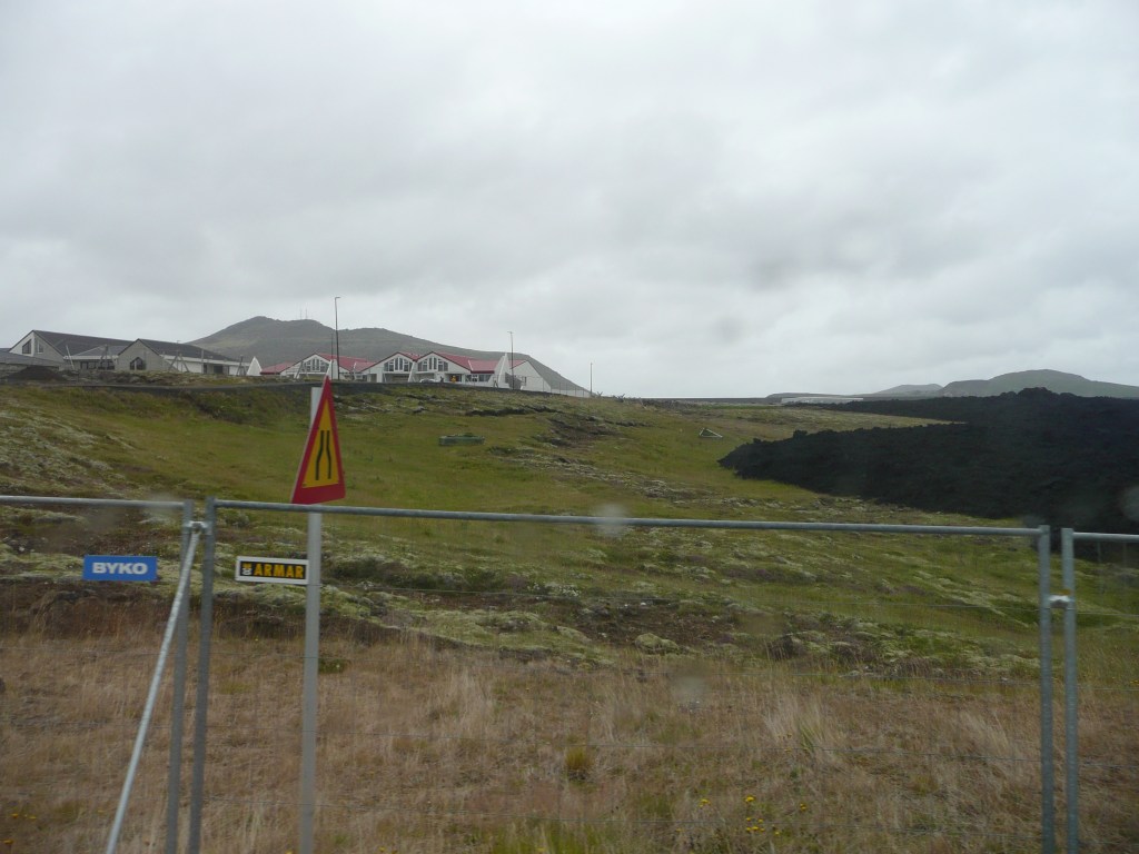
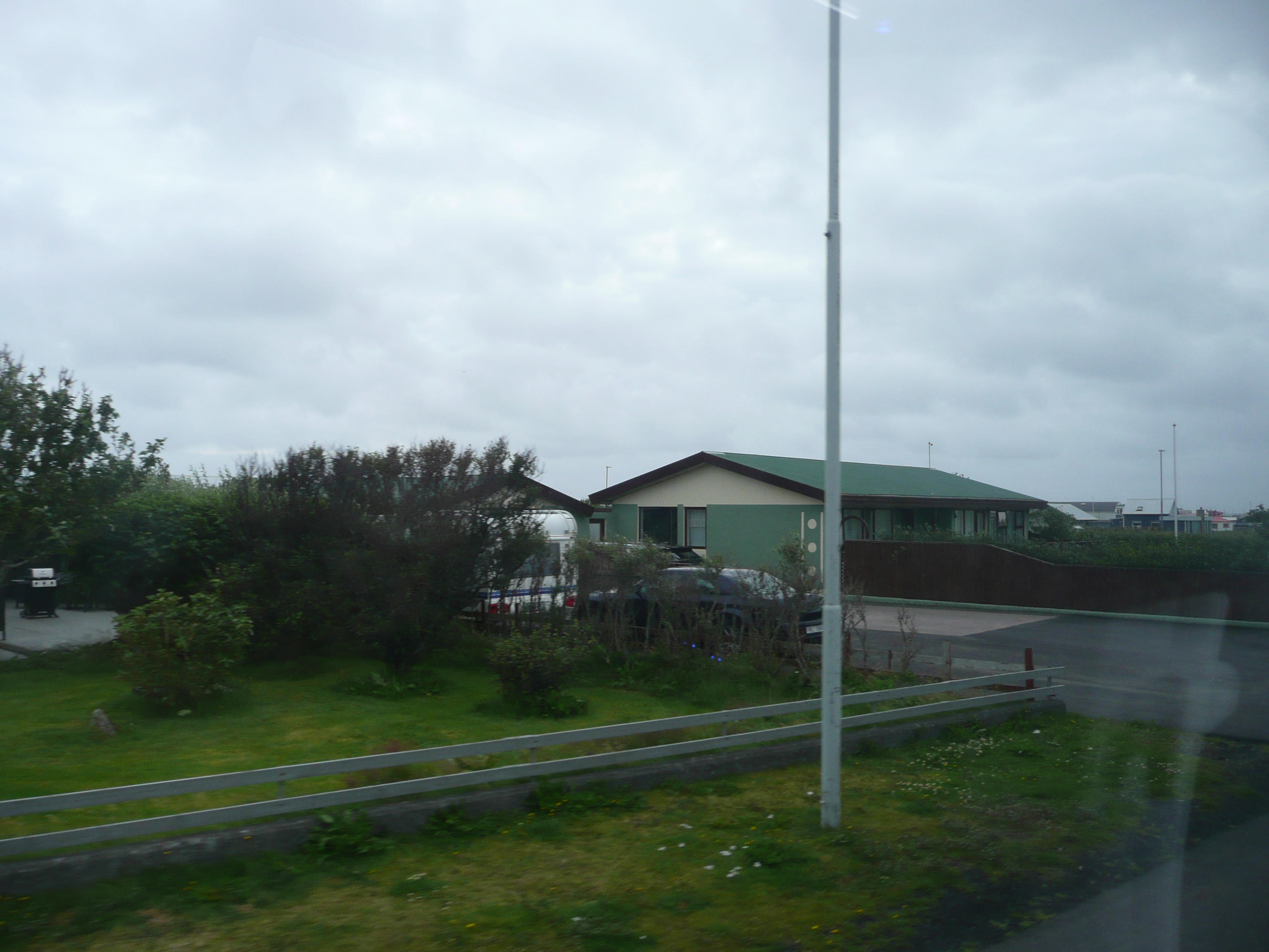
Miasteczko, poza kilkoma domami zalanymi czarną lawą i uszkodzonymi licznymi szczelinami drogami wyglada na nieuszkodzone. W tamtym czasie mieszkańcy zostali ewakuowani i choć lawa może się rozlewać z prędkością pięciu metrów sześciennych na sekundę, to nikomu nic się nie stało. Teraz przed kilkoma domami widziałam zaparkowane samochody – ludzie zaczeli wracać do domów.

The town, aside from a few houses flooded with black lava and roads damaged by numerous fissures, appears undamaged. Residents were evacuated at the time, and although lava can spread at speeds of five cubic meters per second, no one was hurt. Now I saw cars parked in front of several houses—people were starting to return home.

Gejzery, Islandia / Geyzers, Iceland

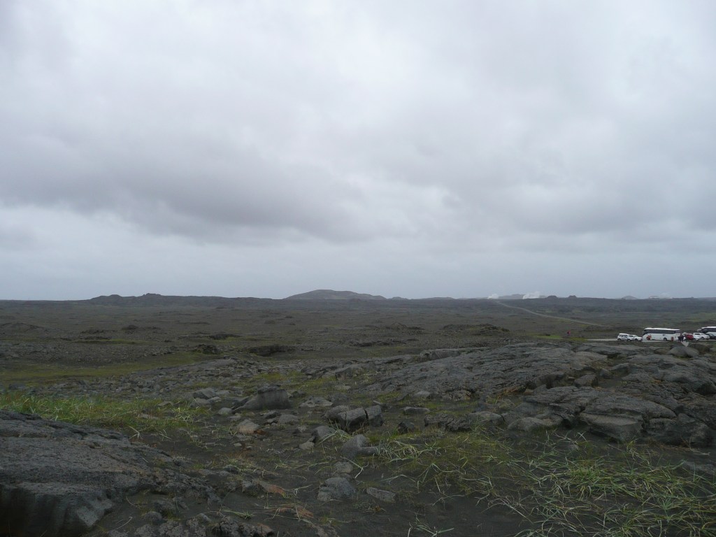
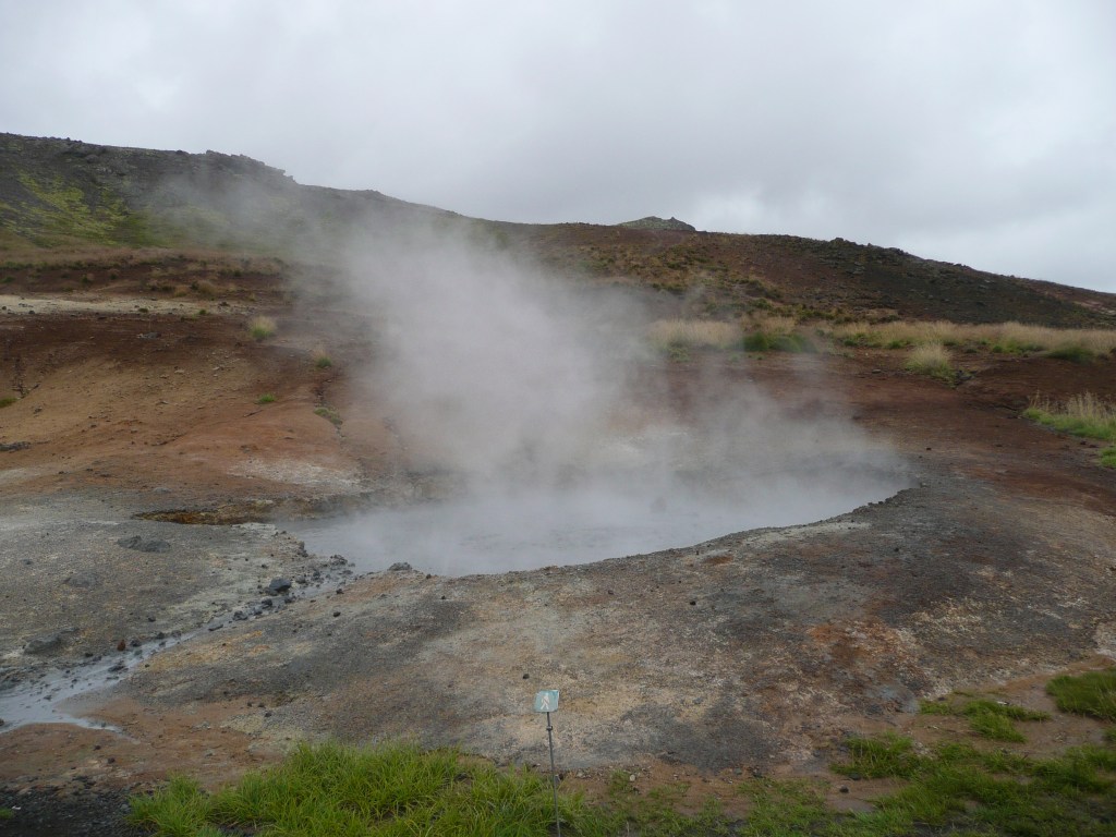
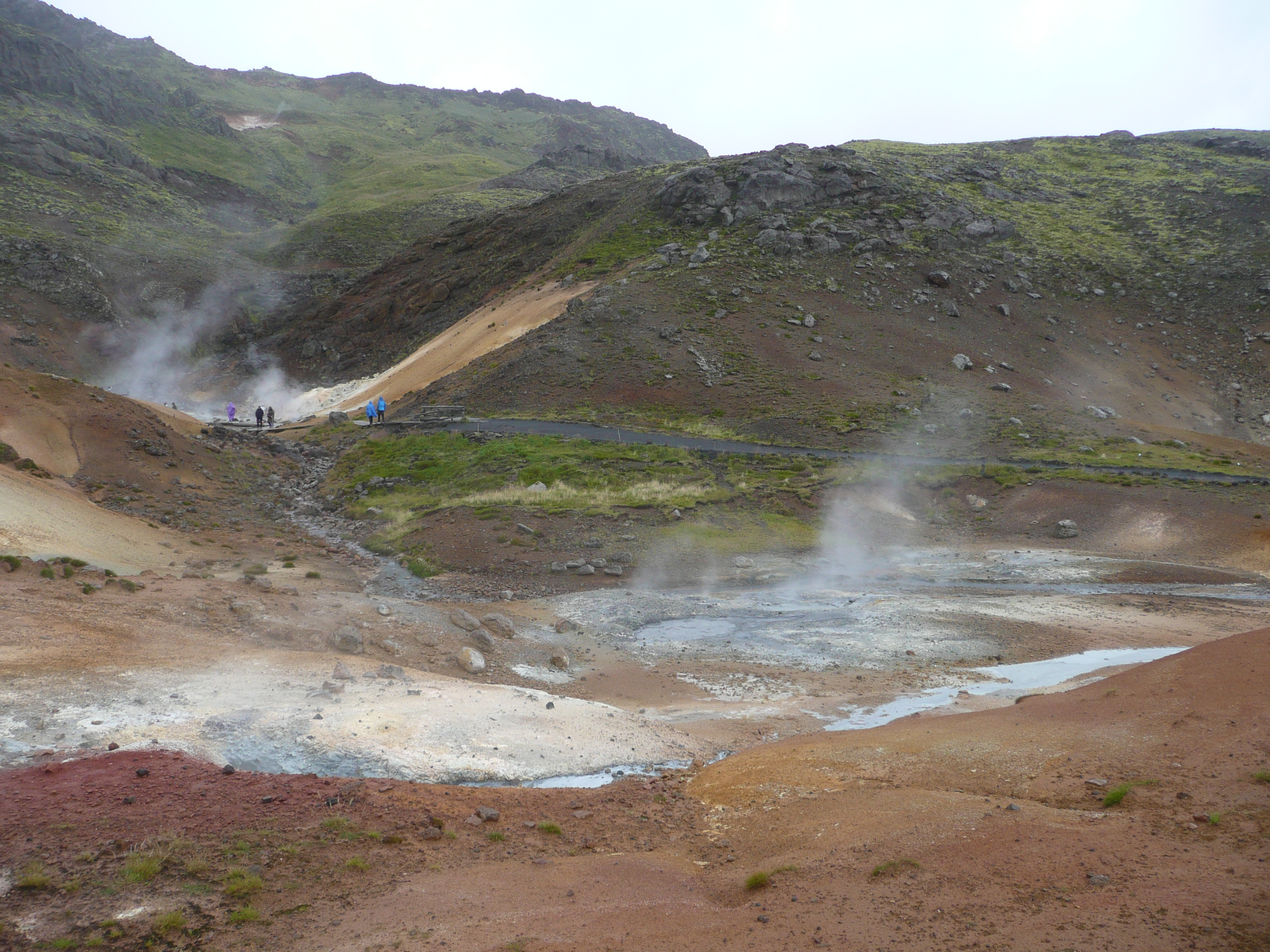
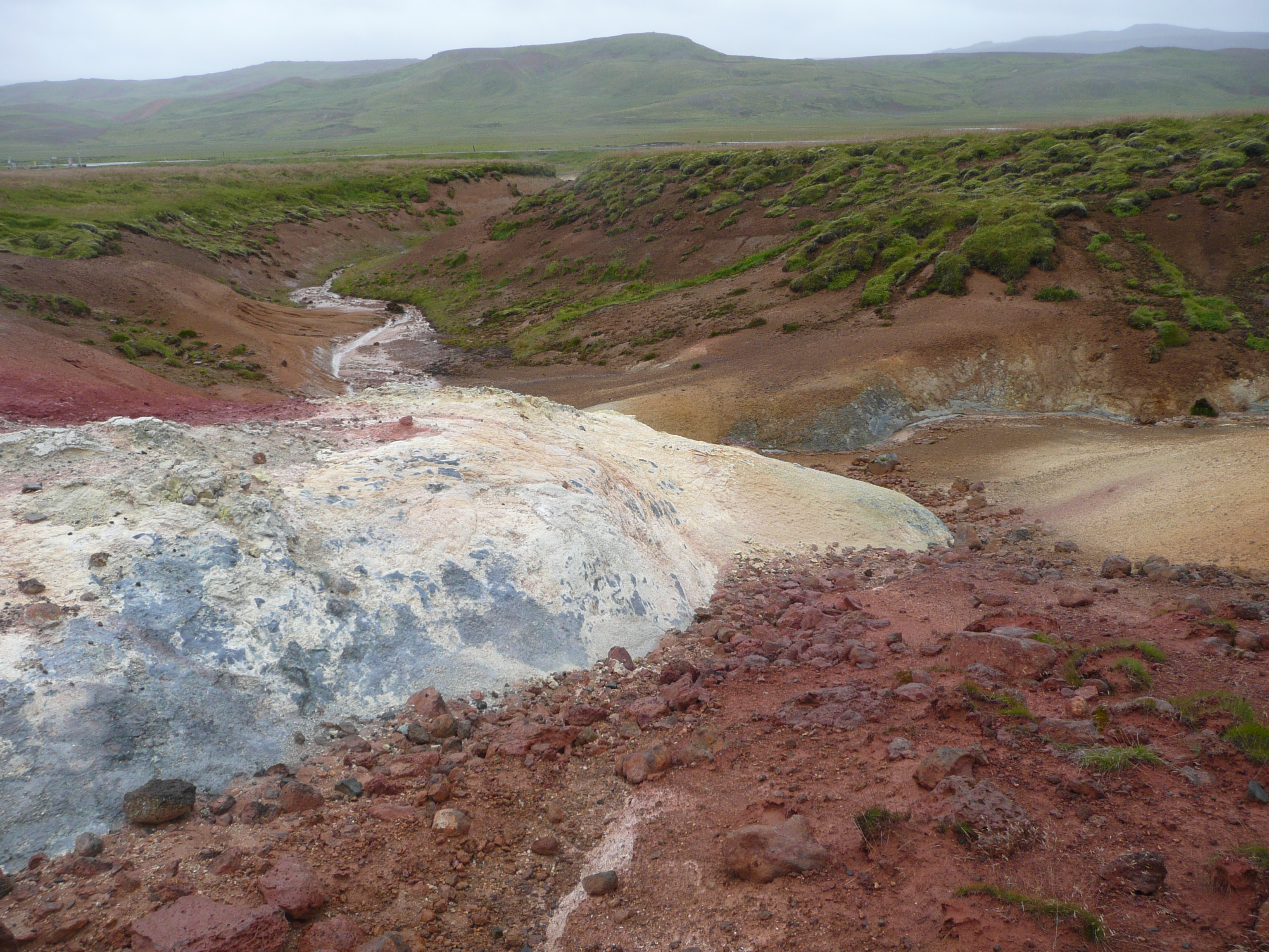
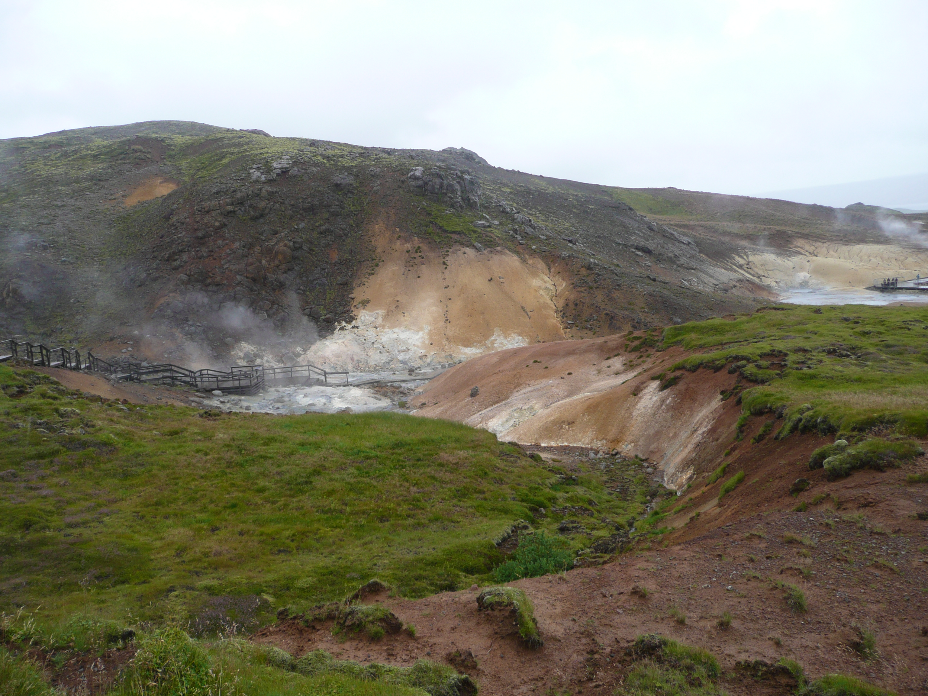
Na horyzoncie widać już parę unoszącą się z gejzerów w dolinie Haukadalur. Geysir to staronordyckie słowo oznaczające… gejzer, a przyjęło sie na całym świecie jako nazwa źródeł termalnych. Okolica wyglada jak droga do Mordoru, a zapach siarki przyprawia mnie o ból głowy.

On the horizon, steam rises from the geysers in the Haukadalur Valley. Geysir is an Old Norse word meaning… geyser, and it’s become the name for thermal springs worldwide. The area looks like the road to Mordor, and the smell of sulfur gives me a headache.

Geysers valley, Iceland / Dolina gejzerów. Islandia

Jedną nogą w Ameryce – One foot in America

Jak wiecie, Ziemia jest płaska i spoczywa na grzbietach czterech słoni: Berilii, Tubula, Wielkiego T’Phona i Jerakeena, stojących na skorupie A’Tuina, wielkiego żółwia płynącego przez Wszechświat… No dobra, kto zna Świat Dysku, ten wie o co chodzi… Ale serio, to mieszkamy na największej na Ziemi płycie tektonicznej, zwanej płytą euroazjatycką. Żyje na niej 75 procent ludności. Na Atlantyku spotyka się ona z płytą północnoamerykańską, a Islandia leży na styku tych dwóch wielkich, tektonicznych potworów, stąd tak częste trzęsienia ziemi. A teraz wyobraźcie sobie, że jesteście w jedynym miejscu na świecie, gdzie możecie stanąć pomiędzy tymi dwiema płytami!

As you know, the Earth is flat and rests on the backs of four elephants: Berilia, Tubul, Great T’Phon, and Jerakeen, standing on the shell of A’Tuin, a giant turtle swimming through the Universe… Okay, those familiar with Discworld know what I mean… But seriously, we live on the largest tectonic plate on Earth, called the Eurasian Plate. Seventy-five percent of the population lives on it. In the Atlantic, it meets the North American Plate, and Iceland lies at the meeting point of these two tectonic monsters, hence the frequent earthquakes. Now imagine being in the only place in the world where you can stand between these two plates!

Jesteśmy w Parku Narodowym Þingvellir, gdzie można zobaczyć tzw. ryft oceaniczny na powierzchni, a nie w głębinach… choć w głębinach też można, nurkując w szczelinie Silfra, wypełnionej krystalicznie czystą wodą. Ale można też przejść przez symboliczny Most Między Kontynentami, zwany także Miðlína. Wysłałam Pana i Władcę do Ameryki, skąd zdążył wrócić, zanim odległość między płytami wzrosła o kolejne 2,5 centymetra (bo o tyle oddalają się od siebie rocznie obie płyty).

We’re in Þingvellir National Park, where you can see the so-called ocean rift on the surface, not in the depths… although you can also dive into the depths, diving the Silfra fissure, filled with crystal-clear water. But you can also cross the symbolic Bridge Between the Continents, also known as Miðlína. I sent my Lord and Master to America, from where he returned before the distance between the plates increased by another 2.5 centimeters (the distance the two plates move apart each year).

Pora ruszać dalej, na spotkanie gejzerów. / It’s time to move on, to meet the geysers.

Reykjanes

Wyruszamy wcześnie po wieeelkim śniadaniu (składającym się głównie ze statkowego najpyszniejszego na świecie chleba i serów, których kolekcja jest imponująca i choćby dlatego warto płynąć „moim statkiem”). Jest zimno i pochmurno, ale mamy czapki i zimowe kurtki. Autokar jedzie wzdłuż wybrzeża, mijając niewielkie osiedla parterowych domów rozrzuconych po obu stronach drogi. W oddali widać parę unoszącą się nad słynną „Niebieską Laguną”, a kawałek dalej białe obłoki nad wielką elektrownią geotermalną w Svartsengi.

We set off early after a hearty breakfast (consisting mainly of the ship’s most delicious bread and cheeses the collection of which is impressive and worth sailing on „my ship” for just that reason alone). It’s cold and overcast, but we’ve got hats and winter jackets. The coach travels along the coast, passing small settlements of single-story houses scattered on both sides of the road. In the distance we can see steam rising from the famous „Blue Lagoon”, and a little further white clouds over the large geothermal power plant in Svartsengi.

Jedziemy na półwysep Reykjanes, na południowy zachód od stolicy. Nazwa półwyspu oznacza „dymiący punkt”. Reykjanes jest częścią globalnego parku UNESCO. Krajobraz jest w kolorach ciemnej szarości, przetykanej gdzieniegdzie zielonością mchu, który wyrasta zaraz po tym, jak deszcz ostudza pola lawy… Wszystko co widać wokół to zastygła lawa. Reykjanes doświadcza wiele erupcji wulkanów od 2021 roku. Niemal każda erupcja poprzedzona jest trzęsieniem ziemi, które wstrząsa magmą, wtedy ziemia rozstępuje się jak wrota piekieł, tworzą się szczeliny, niektóre na wiele kilometrów i lawa wydostaje się na powierzchnię, wypływając często przez wiele miesięcy.

We’re heading to the Reykjanes Peninsula, southwest of the capital. The name translates to „smoking point”. Reykjanes is part of a UNESCO global park. The landscape is a dark gray, interspersed with the green of moss that grows immediately after rain cools the lava fields. All you see is solidified lava. Reykjanes has experienced numerous volcanic eruptions since 2021. Almost every eruption is preceded by an earthquake, which shakes the magma, then the ground splits open like a gates of hell, some extending for kilometers, and lava emerges onto the surface, often for months.

Docieramy do starej latarni morskiej Reykjanesviti, zbudowanej w 1878 roku. Osiem lat później została zniszczona przez trzęsienie ziemi. Odbudowano ją dopiero w 1908. Tereny wokół są wielkim żerowiskiem dla morskich ptaków, a zapach gnijących wodorostów zapiera dech…

We reach the old Reykjanesviti Lighthouse, built in 1878. Eight years later, it was destroyed by an earthquake and rebuilt only in 1908. The surrounding area is a great feeding ground for sea birds, and the smell of rotting seaweed is breathtaking…

Jedziemy drogą nr 45 na południe. Jest trochę bardziej zielono, na nielicznych łąkach pasą się konie, nie tylko islandzkie. Ziemia jest poprzecinana rozpadlinami i bazaltowymi skałami. Wśród skał i wąwozów widać białe owce, zwykle po trzy – mama i dwoje jagniąt. Zaglądamy do niewielkiego kościoła na wzgórzu, a potem skręcamy na północny wschód…

We head south on Route 45. It’s a bit greener, with horses grazing in the few meadows, not just Icelandic ones. The land is crisscrossed with clefts and basalt rocks. Among the rocks and ravines, we see white sheep, usually three in a row—a mother and two lambs. We visit a small church on a hill, then turn northeast…

Islandia – Iceland

Islandia – Iceland

Przepłynęliśmy 3060 kilometrów i jesteśmy na południowo-zachodnim krańcu Islandii. Jest dosyć ciepło, około 14 stopni i nie pada. Słońce wzeszło o 4:27, zajdzie o 22:13, czyli dzień potrwa około osiemnastu godzin. Przybyliśmy do kraju, który ma najstarszy parlament na świecie (założony w 930 roku), gdzie mieszkańcy nie mają nazwisk, gdzie przestępczość jest tak niska, że policja nie nosi broni, gdzie nie ma kolei i komarów (ale są inne stwory, które je zastępują), gdzie czyta się i kupuje najwięcej książek na świecie, a na każdego mieszkańca przypadają trzy owce… Poza tym jest tu około 1000 wodospadów, a ich liczba ciągle rośnie, nie ma żadnego McDonalda, a największą mniejszością są Polacy.

We’ve sailed 3,060 kilometers and are at the southwestern end of Iceland. It’s quite warm, around 14 degrees Celsius, and it’s not raining. The sun rose at 4:27 a.m. and will set at 10:13 p.m., meaning the day will last about eighteen hours. We’ve arrived in a country with the oldest parliament in the world (founded in 930 AD), where residents don’t have surnames, where crime is so low that police don’t carry weapons, where there are no railways or mosquitoes (but other creatures take their place), where the world’s most books are read and purchased, and where there are three sheep for every resident… Besides that, there are about 1,000 waterfalls and their number is constantly growing, there’s no McDonald’s, and the largest minority are Poles.

Islandia – Iceland

Islandia to największa wulkaniczna wyspa na świecie. Wulkany są ciągle aktywne, a dodatkowo wyspa leży na styku dwóch wielkich płyt tektonicznych… Dzięki tej aktywności, Islandczycy mają darmowe zasilanie odnawialną energią wszystkiego – ogrzewania domów, basenów a nawet chodników. Islandia wytwarza ponad 99% energii elektrycznej ze źródeł odnawialnych, a mianowicie z hydroenergii (około 80%) i geotermii ( około 20%).

Iceland is the largest volcanic island in the world. The volcanoes are constantly active, and the island lies at the junction of two large tectonic plates. Thanks to this activity, Icelanders have free renewable energy for everything – heating their homes, swimming pools, and even sidewalks. Iceland generates over 99% of its electricity from renewable sources, namely hydropower (approximately 80%) and geothermal energy (approximately 20%).

Islandia – Iceland

Co by wam jeszcze o Islandii powiedzieć? Język islandzki jest najstarszym używanym językiem w Europie. Klimat, mimo położenia jest łagodny i wcale nie jest przeraźliwie zimno. Temperatura właściwie nie spada poniżej minus dziesięciu stopni, a często oscyluje wokół zera. Większym problemem są wiatry, wiejące często z prędkością ponad 100 km/h, zdolne przewrócić samochód. Poza tym Islandczycy nie mają armii, mieli prohibicję do 1989 roku, a trzy główne stanowiska w państwie – prezydenta, premiera i przywódcy kościoła – zajmują kobiety!

What else can I tell you about Iceland? Icelandic is the oldest spoken language in Europe. Despite its location, the climate is mild and not terribly cold. Temperatures rarely drop below minus ten degrees Celsius, often hovering around freezing. A bigger problem are the winds, which often blow at speeds over 100 km/h, capable of flipping a car. Besides, Icelanders have no army; they had prohibition until 1989, and the three main positions in the country – president, prime minister, and church leader — are held by women!

No to wyruszamy! Well, let’s go!

Północny Atlantyk – North Atlantic

Fale są potężne, wiatr z zachodu ma prędkość prawie 100 km/h. Statkiem huśta niemiłosiernie, ale to dobrze – w restauracji nie ma zbyt wielkiego tłoku, a na siłowni są tylko trzy osoby oprócz mnie. Już się domyślam, dlaczego dopłata za kajutę z balkonem była taka niewielka – bo nie można z niego korzystać przy takiej pogodzie. Kiedy nie wieje jak na Śnieżce, to pasażerowie z sąsiednich kajut urządzają na swoich balkonach cholerne palarnie. Dobra, miałam nie narzekać…

The waves are huge, and the wind is coming from the west at almost 100 km/h. The ship is rocking mercilessly, but that’s a good thing – the restaurant isn’t overly crowded, and there are only three people in the gym besides me. I can already guess why the extra charge for the balcony cabin was so small – because you can’t use it in this kind of weather. When it’s not windy like on Śnieżka moutain, the passengers in the neighboring cabins set up their own damned smoking areas on their balconies. Okay, I wasn’t supposed to complain…

North Atlantic and stormy weather – Północny Atlantyk i sztorm

Wieczorem świat wkół statku nieco się uspokaja, za to pojawia się mgła. Zasypiam z myślą, że powinni koniecznie włączyć jakieś buczenie (według prawa morskiego statek o napędzie mechanicznym w ruchu powinien wydawać jeden długi dźwięk co 2 minuty), bo jesteśmy już blisko brzegu. Skąd wiem? Bo wpadłam na pomysł, żeby włączyć radio w telefonie i zeskanować częstotliwości. I usłyszałam ładnie brzmiący język, którego nigdy jeszcze nie słyszałam. Jutro dopłyniemy.

In the evening, the world around the ship calms down a bit, but fog settles in. I fall asleep thinking they should definitely turn on some sort of buzzer (according to maritime law, a powered vessel underway should emit one long beep every two minutes) because we’re already close to shore. How do I know? Because I got the idea to turn on the radio on my phone and scan the frequencies. And I heard a beautiful-sounding language I’d never heard before. We’ll arrive tomorrow.

North Arlantic – great fog / Północny Atlantyk – wielka mgła

Północ, północny zachód – North, northwest

Płyniemy drugi dzień. Wieje silny zachodni wiatr, temperatura 11 stopni. Fale są wysokie, trochę kołysze, zwłaszcza na 12 pokładzie gdzie przesiadujemy w wielkiej statkowej restauracji z bufetem. Na tym samym pokładzie są dwa baseny, opanowane przez wrzeszczące dzieci, które sprawiają, że nie mam zamiaru nawet tam zaglądać. Za to na siłowni dzieci nie ma, za to są dziesiątki spoconych ludzi, próbujących spalić obfite śniadanie na rowerach, bieżniach i atlasach. Moje przejechane na rowerze 10 kilometrów na nikim nie zrobiłoby wrażenia, ale dla mnie to zachęta do poszukania małego conieco w bufecie…

We’re sailing on our second day. A strong westerly wind is blowing, and the temperature is 11 degrees Celsius. The waves are high and there’s a bit of rocking, especially on deck 12, where we hang out in the ship’s large buffet restaurant. On the same deck are two swimming pools, overrun by screaming children, which makes me not even want to go there. There are no children in the gym, though, instead there are dozens of sweaty people trying to burn off a hearty breakfast on bikes, treadmills, and multi-gyms. My 10-kilometer bike ride wouldn’t impress anyone, but it’s an incentive for me to find a little something at the buffet…

W tej restauracji jest codziennie pieczony chleb, ale jaki… Najlepszy na świecie, lepszy nawet od tego, jaki pamięta się z dzieciństwa… Poza cudownym chlebem jest mnóstwo wspaniałych rzeczy do jedzenia i picia, nawet dla takiej rozpuszczonej wegetarianki jak ja. Myślę, że najpóźniej jutro przestanę się mieścić w spodnie.

This restaurant bakes bread daily, but what a bread… The best in the world, even better than the one you remember from your childhood… Besides the wonderful bread, there are plenty of wonderful things to eat and drink, even for a spoiled vegetarian like me. I think I’ll stop fitting into my pants by tomorrow at the latest.

Norden North Sea – północne Morze Północne

Dziś rano jeszcze towarzyszyły nam mewy i widać było wieże wiertnicze. Dziś północne Morze Północne jest puste aż po horyzont. Kolor wody zmienia się od ciemnego granatu po odcienie złota, miedzi i srebra, przetykane bielą morskiej piany. Nasza pozycja to mniej więcej 61 stopni 21′ szerokości geograficznej północnej i 9 stopni 34″ długości zachodniej (podaję te dane dla zapalonych nawigatorów). W nocy przepłynęliśmy pomiędzy archipelagami Orkadów i Szetlandów, leżącymi około 200 kilometrów od wybrzeży Szkocji. I zmieniliśmy czas ze środkowoeuropejskiego na GMT, czyli Greenwich Mean Time (znany również jako czas zachodnioeuropejski lub UTC+00:00).

This morning, we were still accompanied by seagulls and visible oil rigs. Today, the northern North Sea is empty to the horizon. The water’s color varies from dark navy blue to shades of gold, copper, and silver, flecked with white sea foam. Our position is approximately 61 degrees 21′ north latitude and 9 degrees 34″ west longitude (I’m providing this information for keen navigators). During the night, we sailed between the Orkney and Shetland archipelagos, located about 200 kilometers off the coast of Scotland. And we changed the time from Central European Time to GMT, or Greenwich Mean Time (also known as Western European Time or UTC+00:00).

Northen North Sea – północne Morze Północne

Płyniemy ze stałą prędkością 12,5 węzła (około 23 km/godz). Kapitan mówił, że płyniemy wolno ze względu na wysokie fale. Dla mnie mogliby płynąć jeszcze wolniej. Najważniejsze jest to, że jestem na morzu. Nareszcie zasypiam bez problemu, bo wszystkie zmartwienia zostały na brzegu. Cóż, „Navigare necesse est, vivere non est necesse”…

We’re sailing at a steady 12.5 knots (about 23 km/h). The Captain said we were going slowly because of the high waves. To me, they could have gone even slower. The most important thing is that I’m at sea. I’m finally falling asleep without any problems, because all my worries have been left on the shore. Well, „Navigare necesse est, vivere non est escesse”…

Mój Statek – My Ship

Rano wsiadamy do pociągu i po godzinie i jednej przesiadce wysiadamy na Dworcu Głównym w Bremerhaven – brzydkim mieście z wielkim portem (też brzydkim), z którego wyruszymy. Z okien autobusu widzimy maszty wielkich i małych żaglowców i szarego U-boota zacumowanego przy jednym z nabrzeży, ogromne statki handlowe i nasz, wielkości sporego, 14-piętrowego bloku mieszkalnego. Nazywa się „Mein Schiff”, czyli „mój statek”. Potem stoimy w wielkiej kolejce do odprawy, a po godzinie wrzucamy nasze dwie walizki do szafy w kajucie numer 7146. Po raz pierwszy będziemy mieszkać na siódmym pokładzie i po raz pierwszy mamy balkon!

In the morning, we board the train and, after an hour and a change, we disembark at Bremerhaven Central Station – an ugly city with a large port (also ugly), from which we will depart. From the bus windows, we see the masts of sailing ships large and small, a gray U-boot moored at one of the quays, enormous merchant ships, and our own, the size of a large, 14-story apartment building. It’s called „Mein Schiff,” meaning „my ship.” Then we stand in a long line to check in, and an hour later, we’re stuffing our two suitcases into the closet in cabin number 7146. For the first time, we’ll be staying on the seventh deck, and for the first time, we’ll have a balcony!

O 17:00 słyszymy buczenie syreny okrętowej i odprowadzani przez pilota wyruszamy najpierw do ujścia Wezery, a potem na zimne Morze Północne.

At 5:00 p.m. we hear the sound of the ship’s horn and, accompanied by the pilot, we set off first to the mouth of the Weser and then to the cold North Sea.

Mouth of the Weser River – Ujście rzeki Wezery

Długo siedzę na naszym balkonie, smagana zimnym wiatrem Morza Północnego i patrzę na szare fale. Nareszcie na morzu!

I sit on our balcony for a long time, buffeted by the cold North Sea wind, gazing at the gray waves. Finally, at sea!

North Sea – Morze Północne