Loch Ness

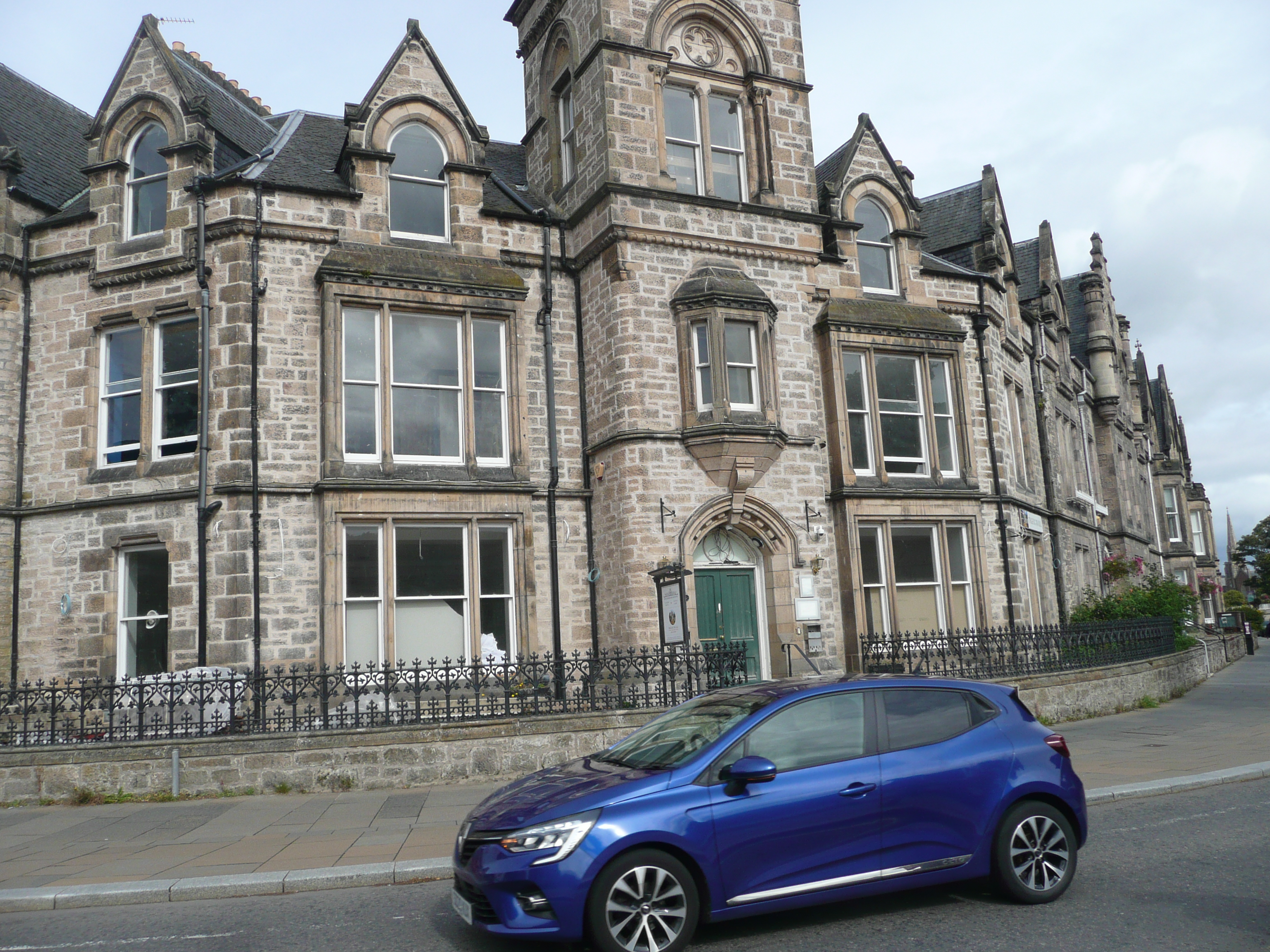
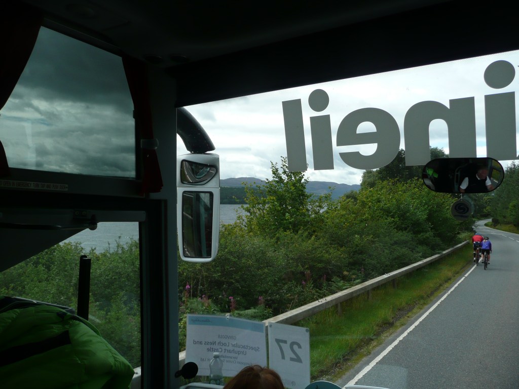
Jedziemy straszliwie zatłoczoną drogą A82 na południowy zachód. Po drodze mijamy twierdze, pola walk, zamki szkockich klanów i siedziby miliarderów (najbogatszym człowiekiem w Szkocji jest Duńczyk, własciciel firmy ASOS). Mijamy też różnych idiotów, którzy tuż obok mają ścieżkę rowerową, ale wolą zginąć pod kołami…

We’re driving southwest along the horribly congested A82. Along the way, we pass fortresses, battlefields, Scottish clan castles, and billionaire residences (the richest man in Scotland is a Dane, the owner of ASOS). We also pass various idiots who have a bike path right next to them but they prefer to die under the wheels …

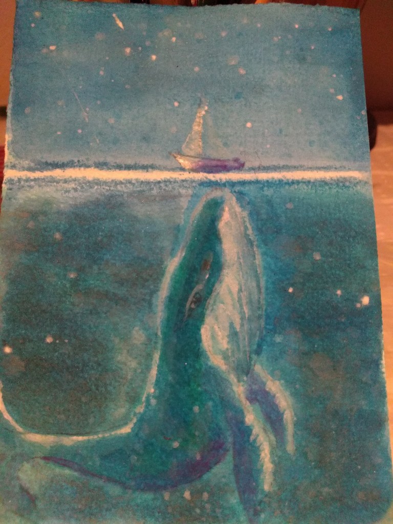
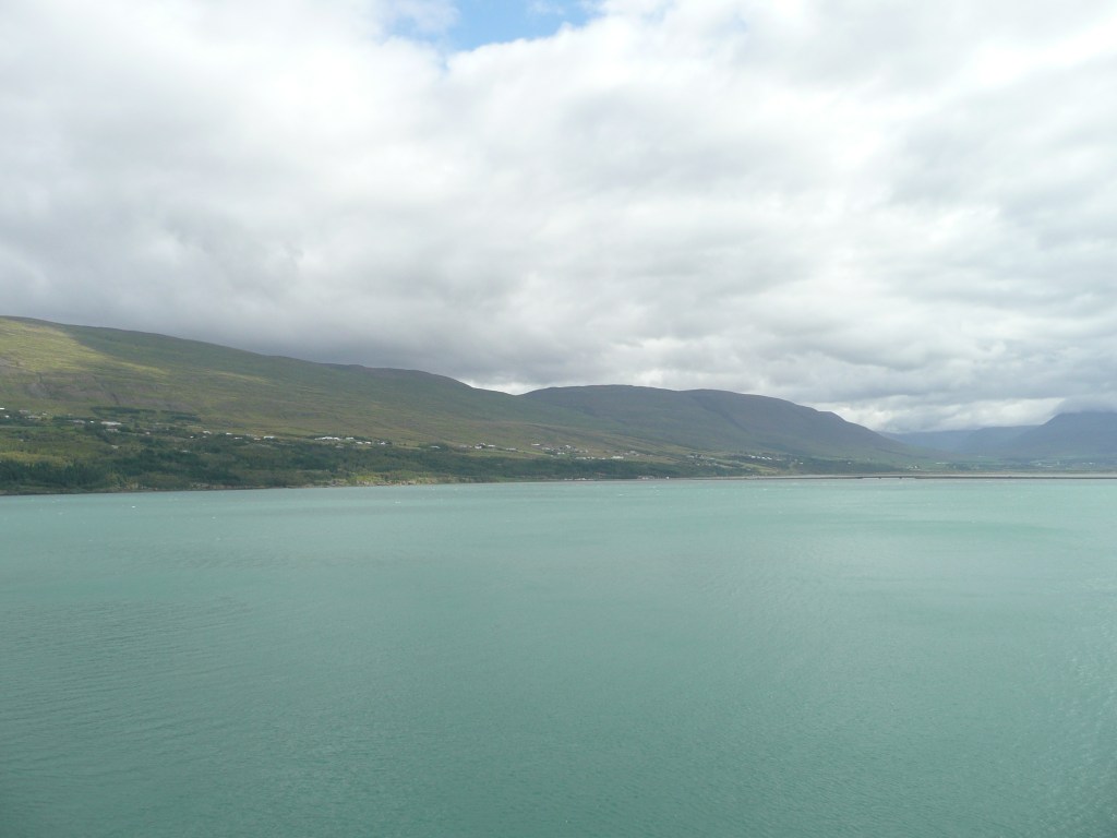
Zmierzamy do zamku Urquhart (Caisteal na Sròine), a właściwie ruin leżących na zachodnim brzegu najbardziej znanego jeziora na świecie – Loch Ness. Jezioro jest wąskie, ale ma około 37 kilometrów długości. Jest też niesamowicie głębokie (w najgłębszym miejscu ma 227 metrów!), a jego wody są ciemne i ponure… Jak wiecie w jeziorze mieszka legendarna istota, rozpalająca wyobraźnię od VI wieku i przynosząca Szkocji ogromne dochody. Nie będę pisać o Nessie, bo wystarczy obejrzeć film „Koń wodny”, w którym wszystko jest wyjaśnione (Film „Koń wodny: legenda głębin” z 2007 roku).

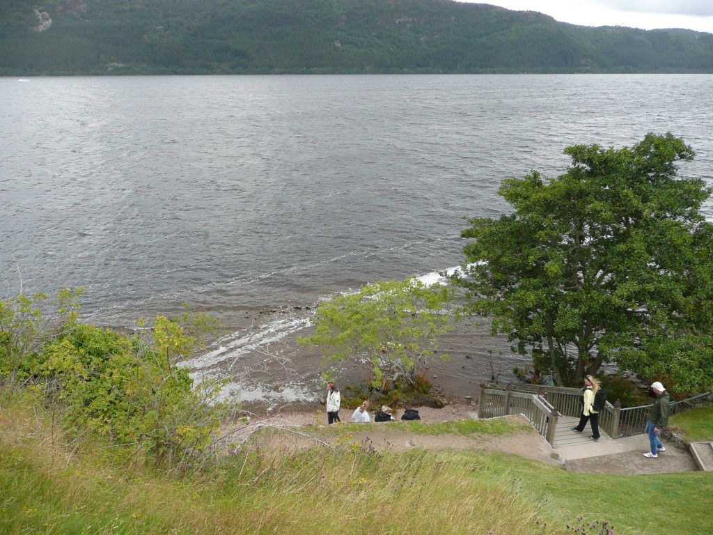
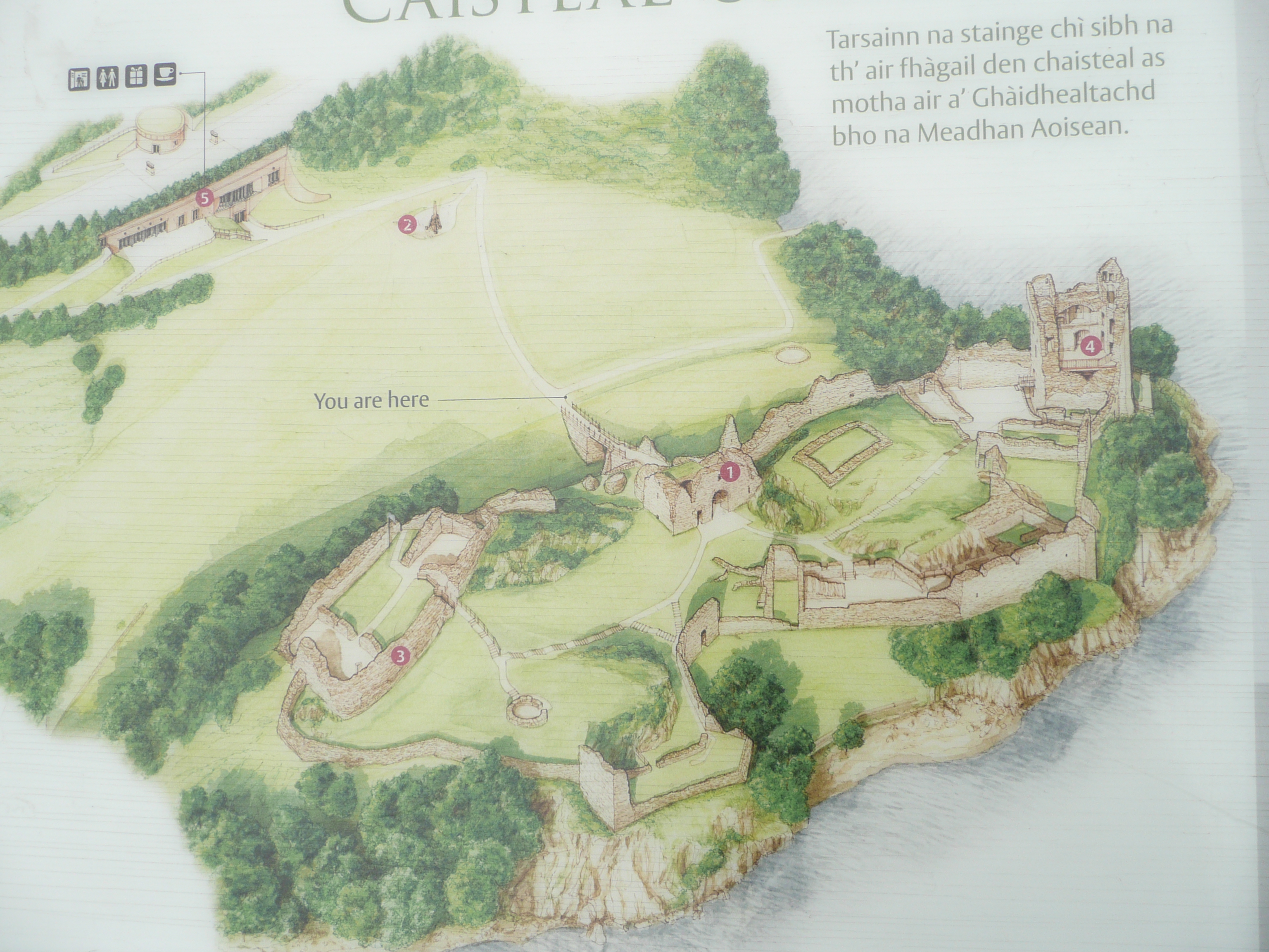
We’re heading to Urquhart Castle (Caisteal na Sròine), or rather ruins, lying on the western shore of the world’s most famous loch – Loch Ness. The loch is narrow, about 37 kilometers long. But it’s incredibly deep (at its deepest point, it’s 227 meters!), and its waters are dark and gloomy. As you know, the loch is home to a legendary creature, one that has captured the imagination since the 6th century and brought Scotland a huge income. I won’t write about Nessie, because in the movie „The Water Horse” everything is explained (the 2007 film „The Water Horse: Legend of the Deep”).

Loch Ness

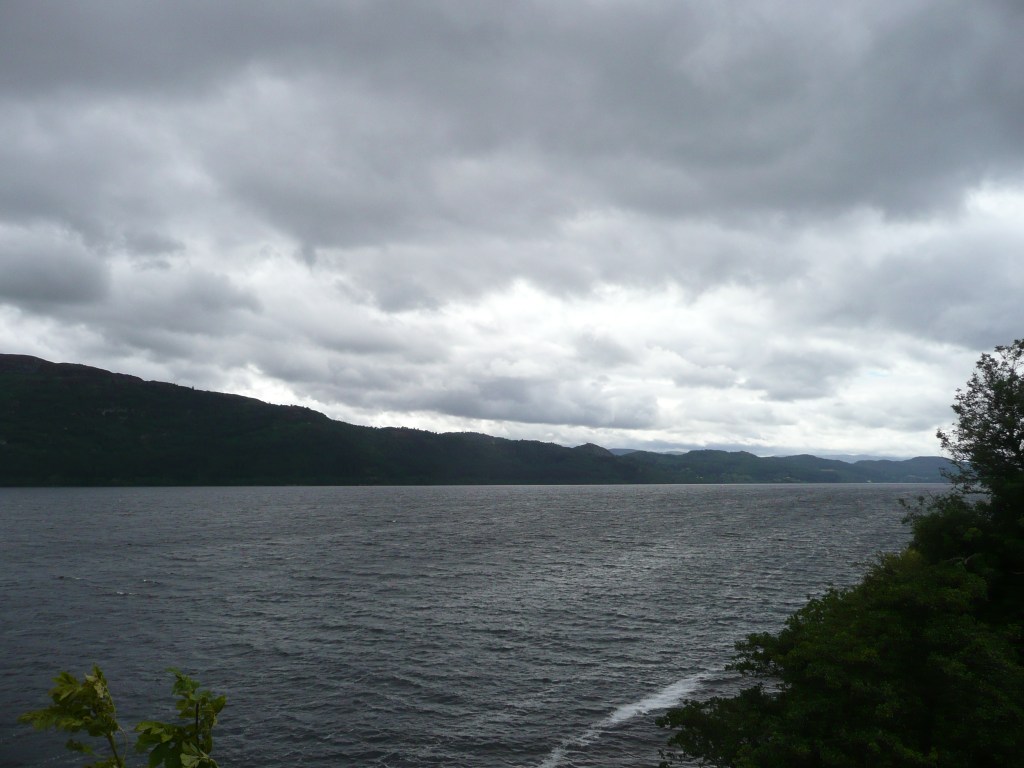
Jezioro jest otoczone górami, słodkowodne, polodowcowe, a jego wody zawdzięczają swój ciemny kolor torfowi. Po prawie godzinie możemy wysiąść z autokaru i powędrować w dół wieloma schodami na błonia zamku Urquhart.

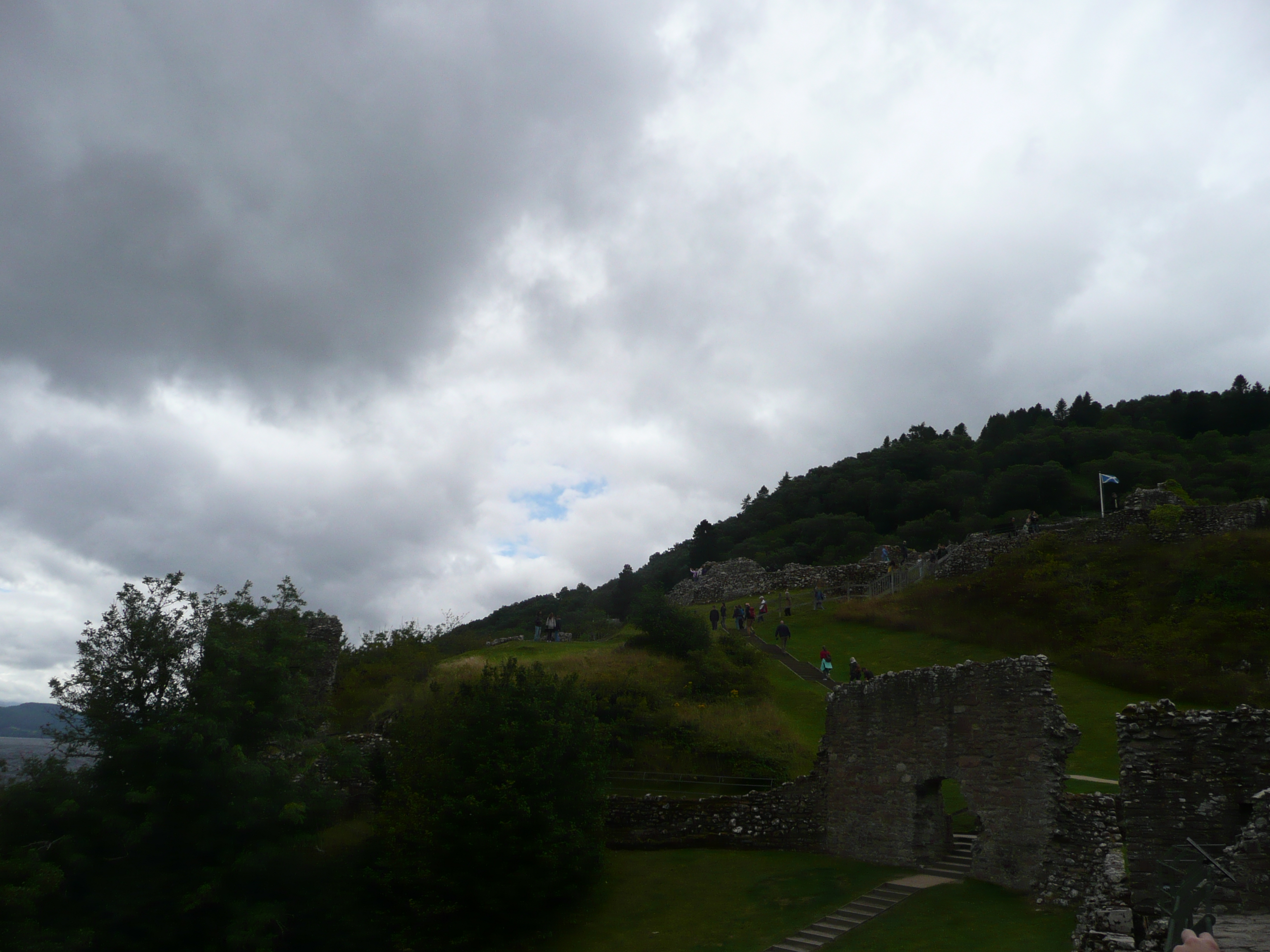
Surrounded by mountains, the lake is freshwater, glacial, and its waters owe their dark color to peat. After almost an hour, we disembark the coach and hike down the many steps to the grounds of Urquhart Castle.

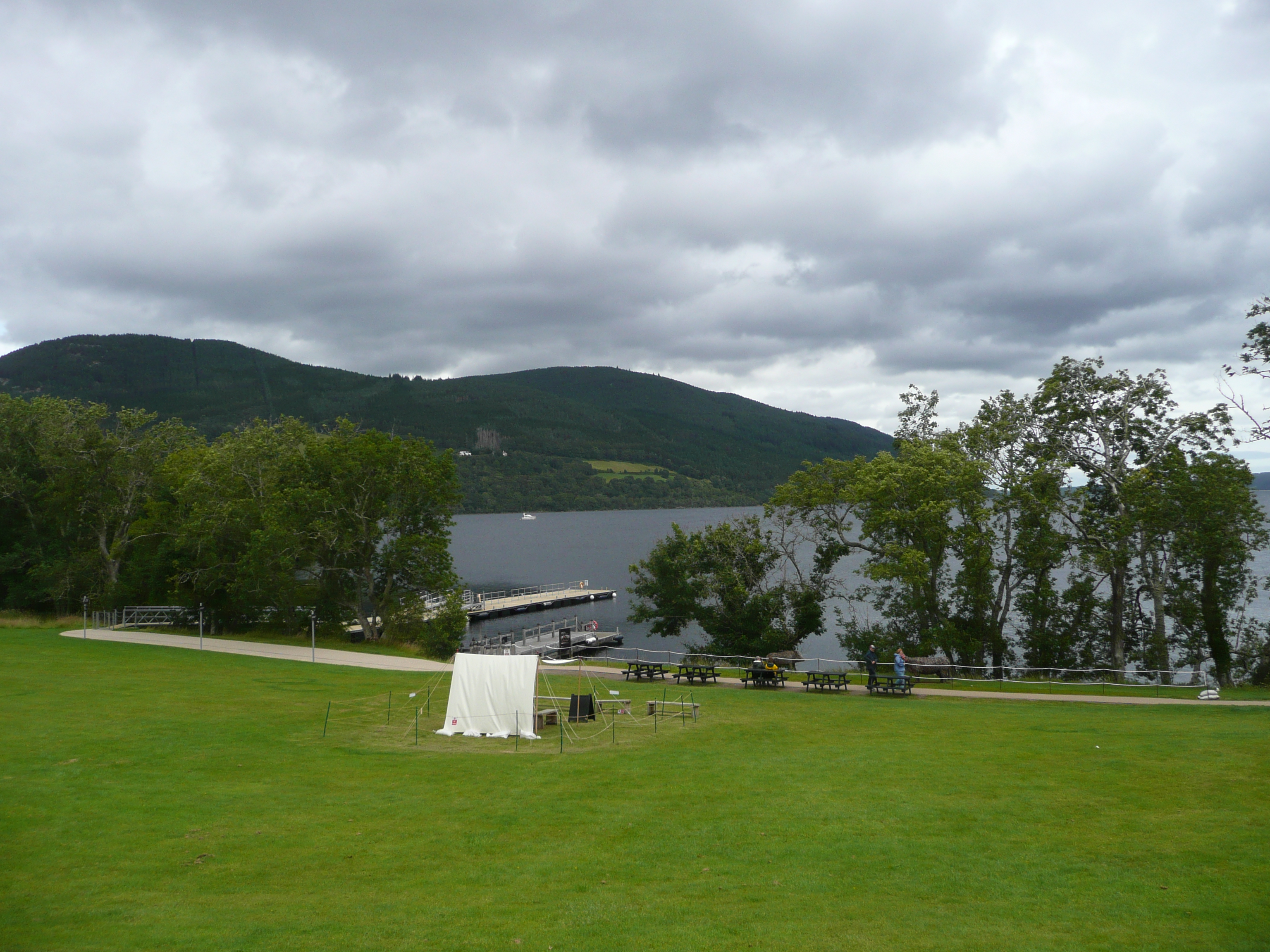
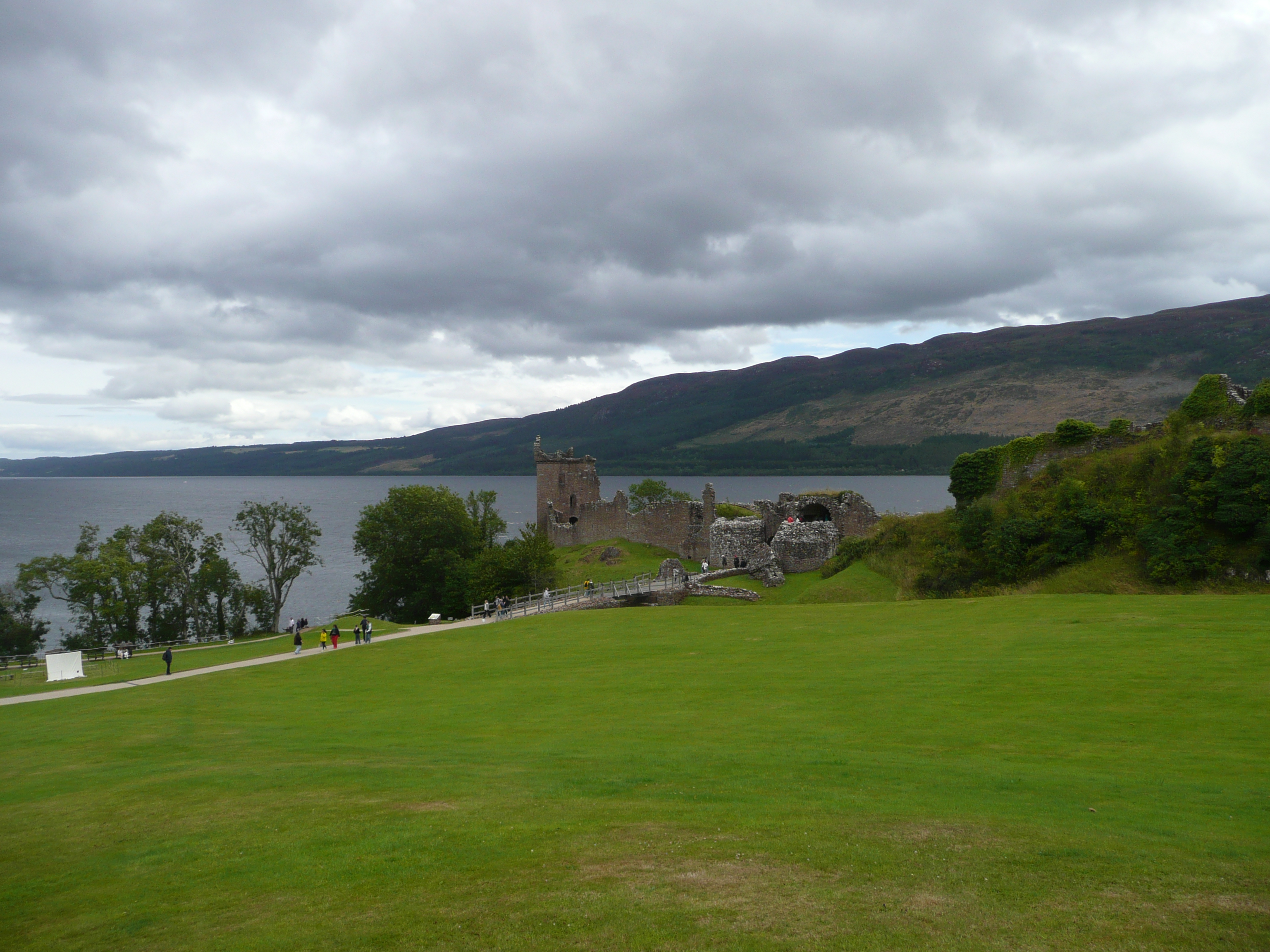
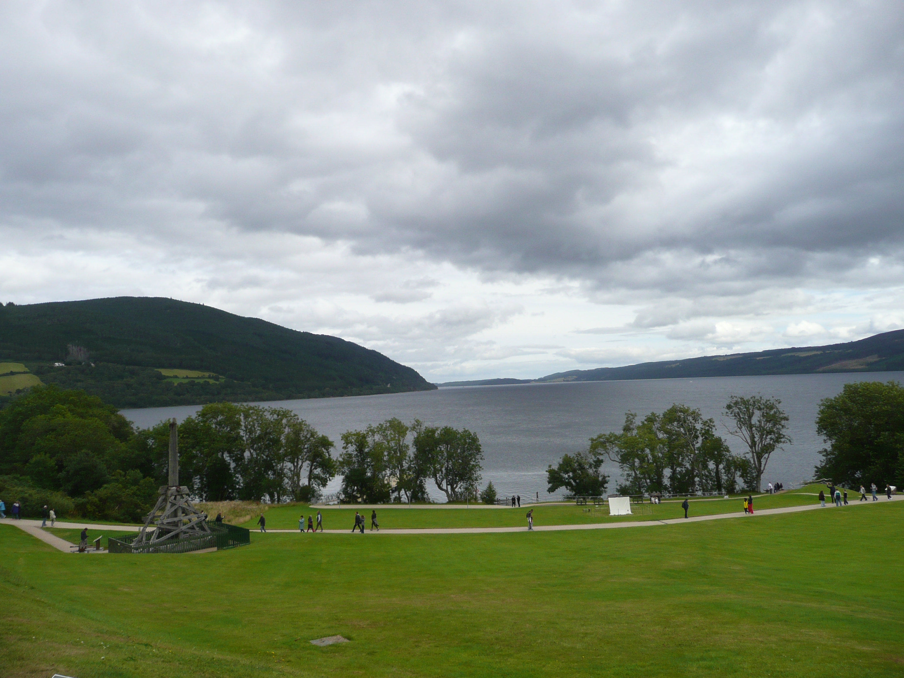
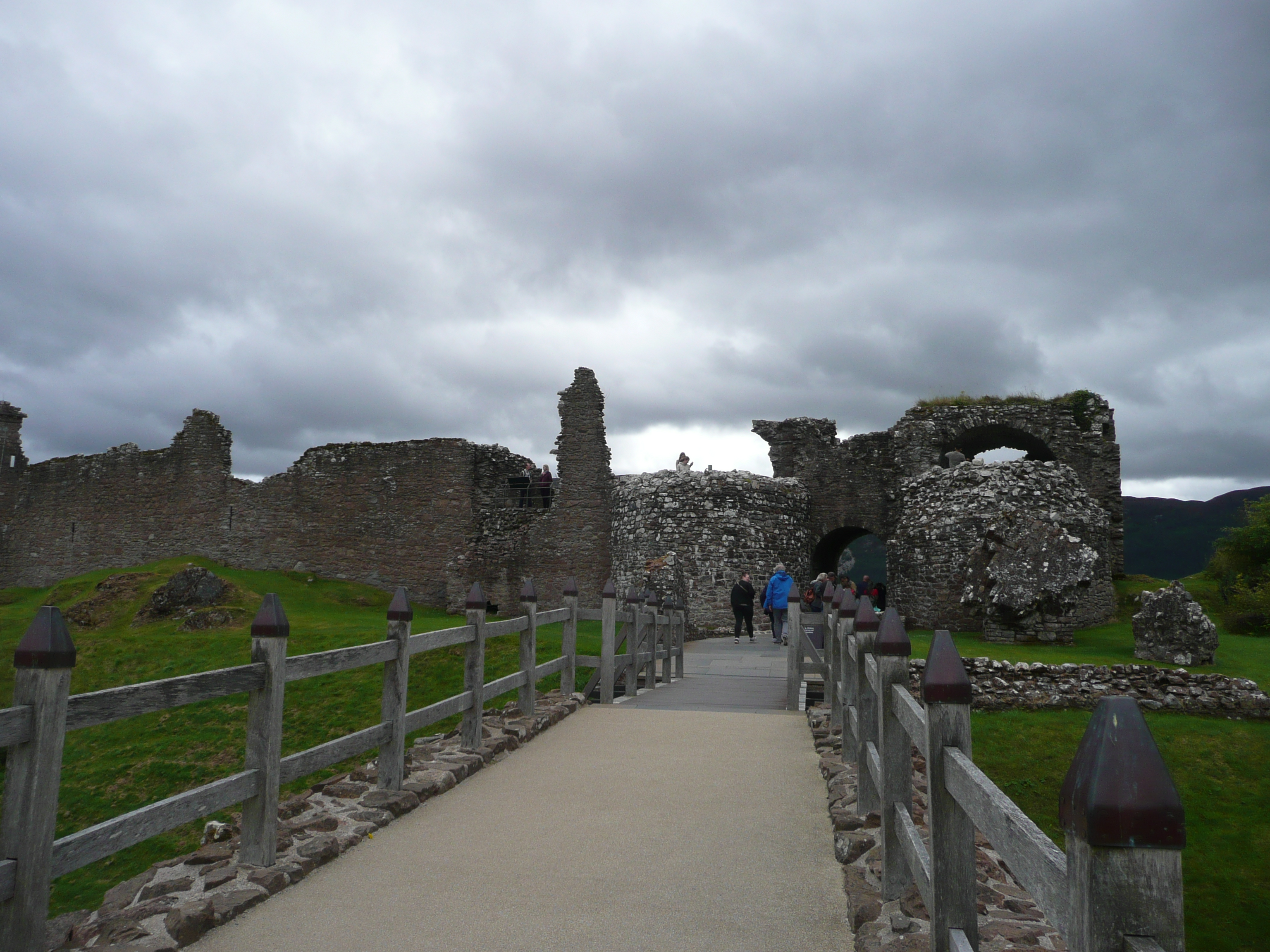
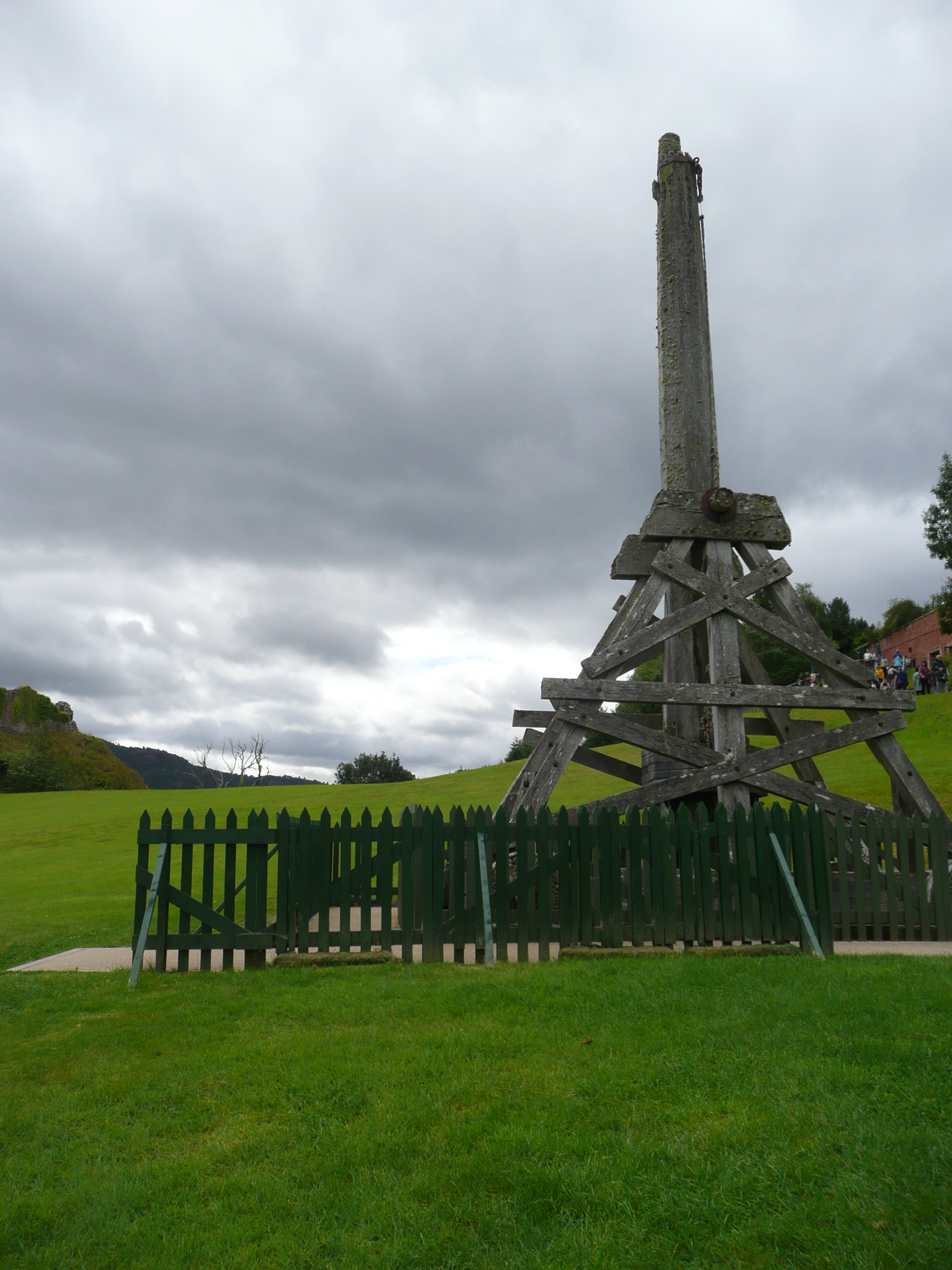
Ruiny zamku nie robią na mnie wielkiego wrażenia. Mamy lepsze na Szlaku Orlich Gniazd, ale widok stąd na jezioro jest fantastyczny. Sam zamek powstał w 12 wieku, a jego historia odzwierciedla szalone dzieje Szkocji – bitwy, klanowe walki o wpływy, wojen o niepodległość i szkockich powstań przeciwko Koronie. Od 17 wieku stopniowo zamieniał się w ruinę, obecnie należy do National Trust for Scotland. Z przystani można popłynąć stateczkiem do Dochgarroch Lock czy Fort Augustus, albo po prostu popływać po jeziorze w poszukiwaniu Nessie.

The castle ruins don’t impress me much. We’ve seen better ones on the Eagle’s Nest Trail, but the view of the lake from here is fantastic. The castle itself was built in the 12th century, and its history reflects Scotland’s frenetic history—battles, clan power struggles, wars of independence, and Scottish uprisings against the Crown. Since the 17th century, it has gradually fallen into ruins and is now owned by the National Trust for Scotland. From the pier, you can take a boat to Dochgarroch Lock or Fort Augustus, or simply cruise the lake in search of Nessie.

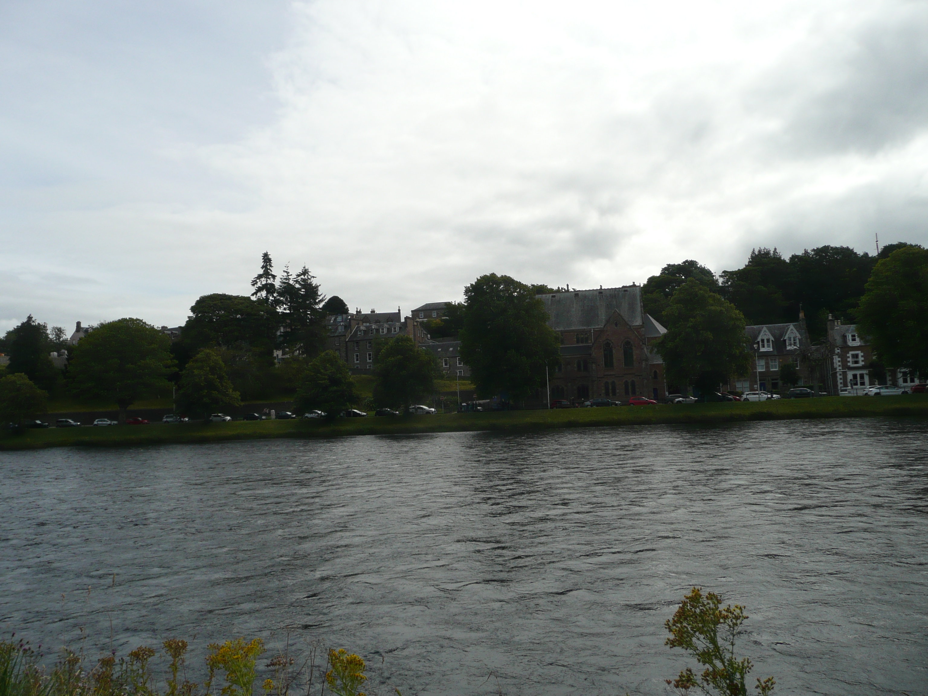
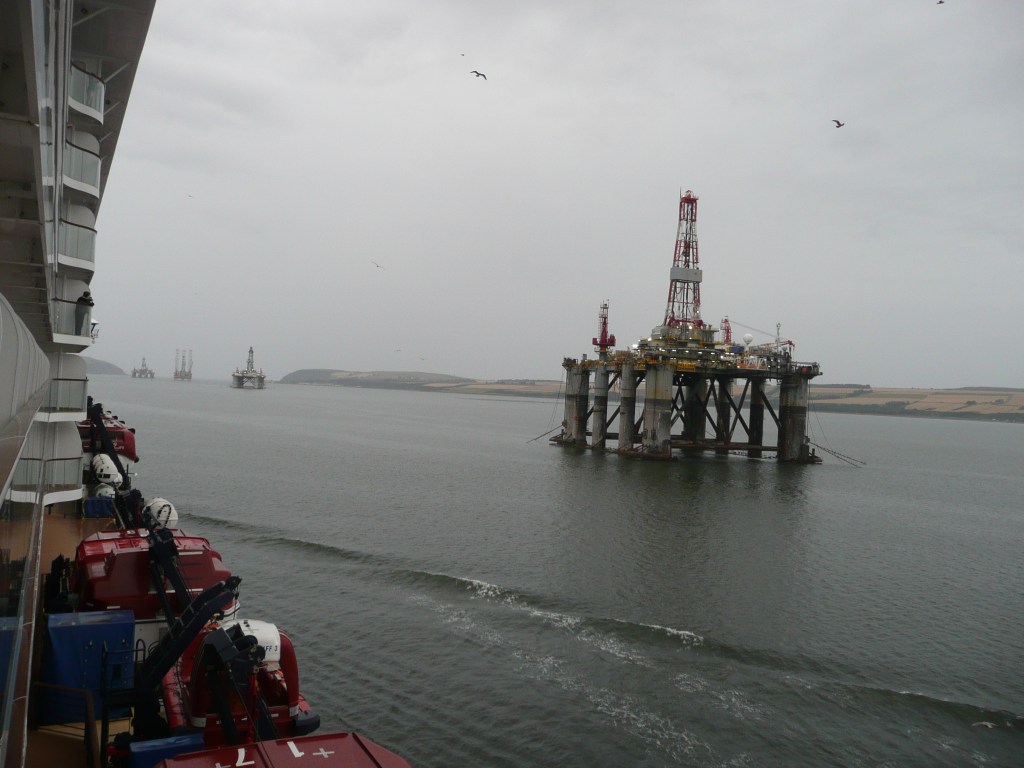
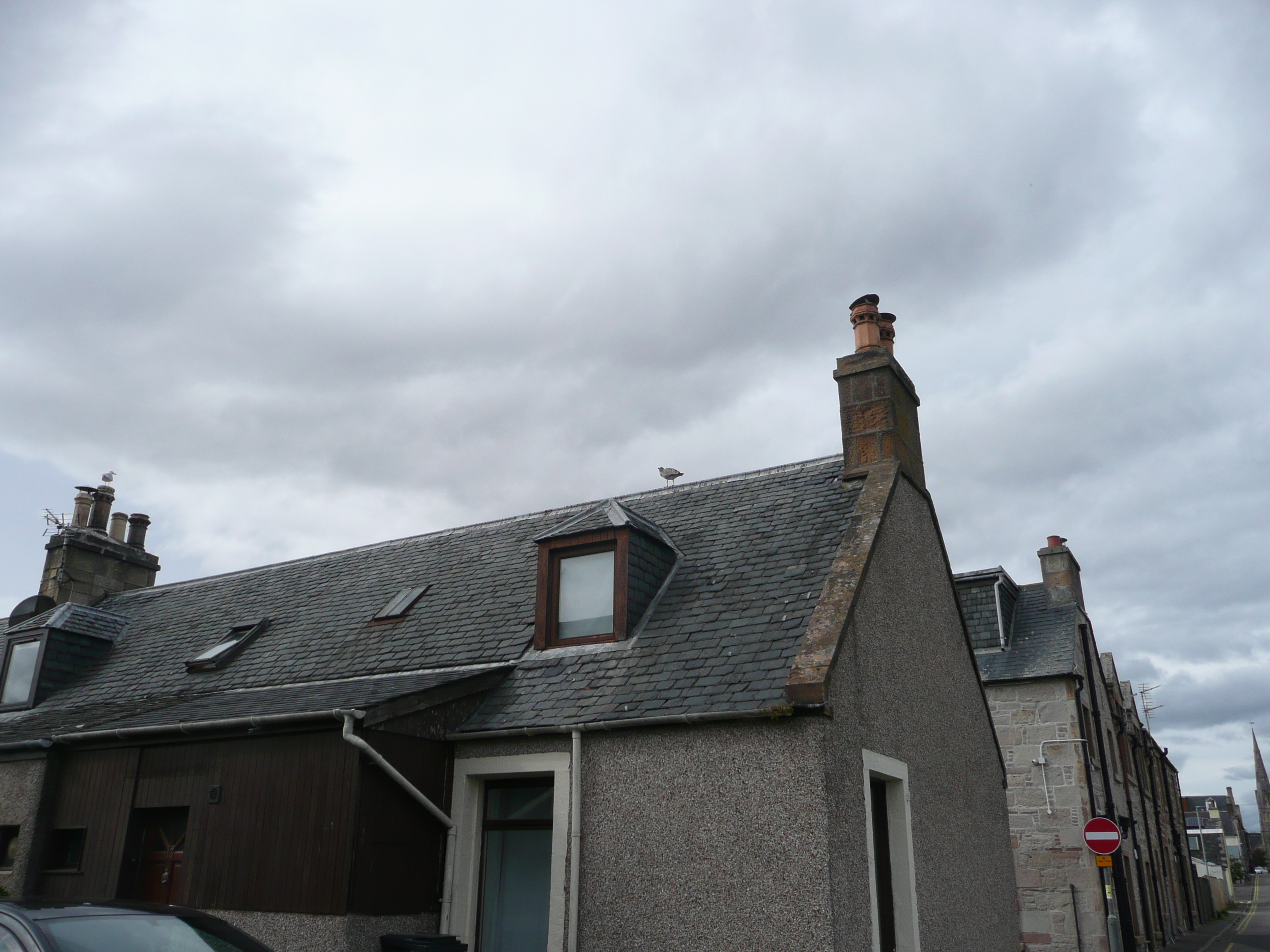
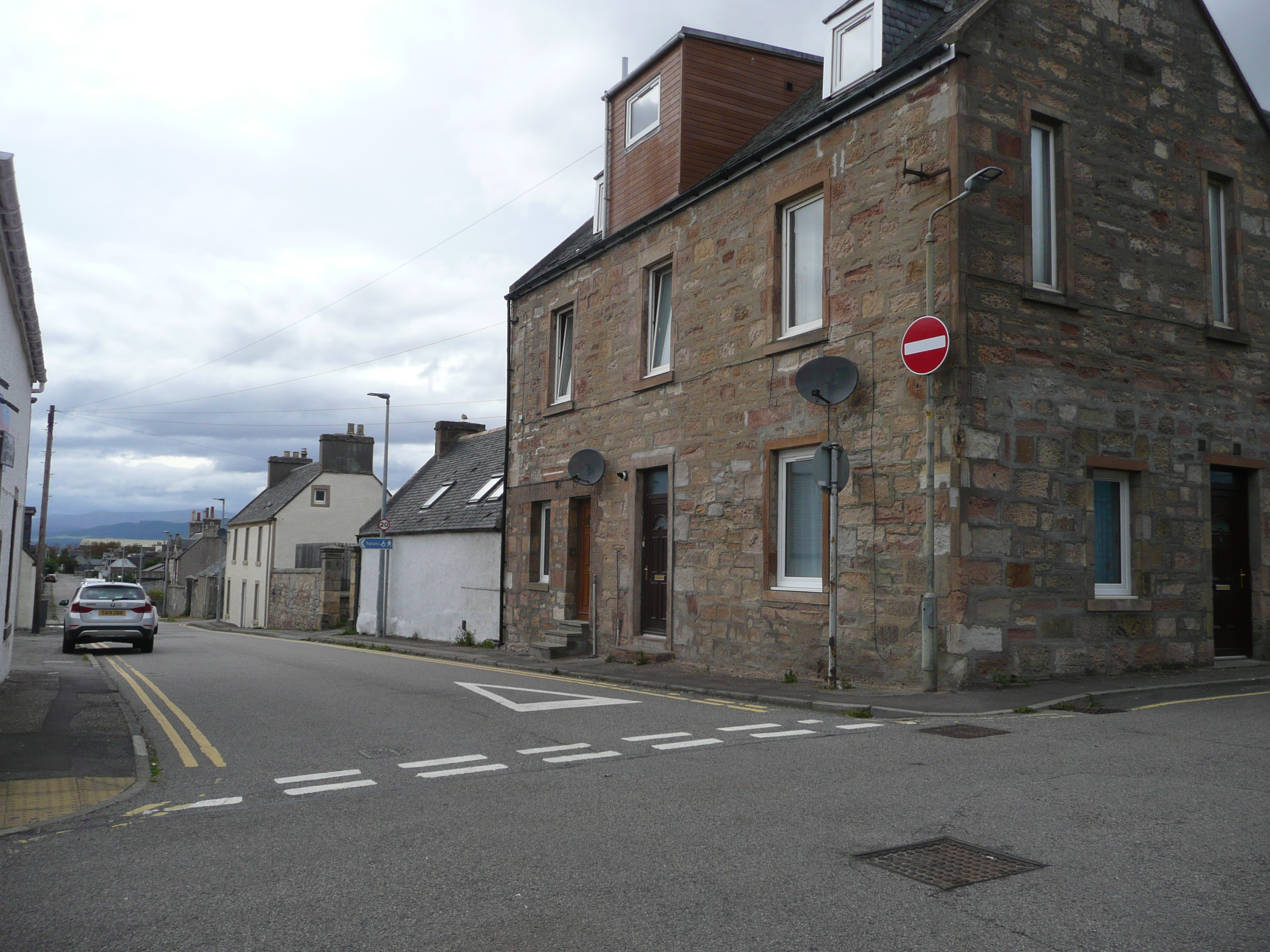
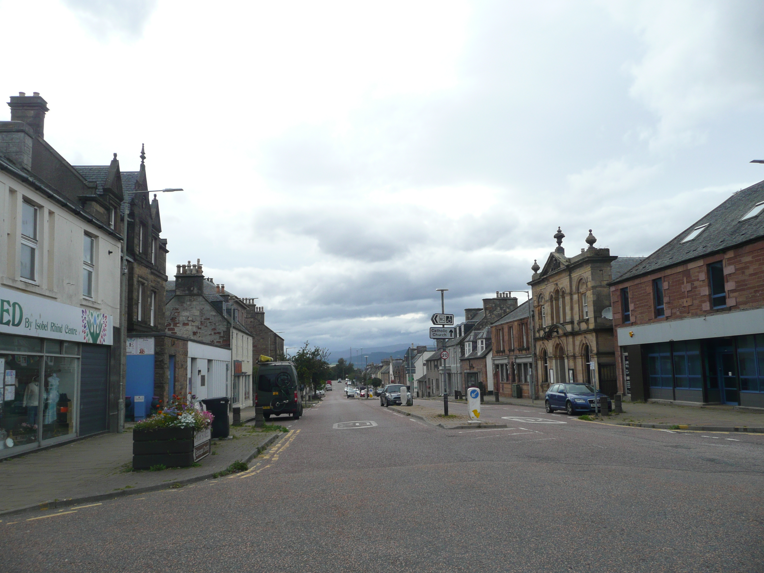
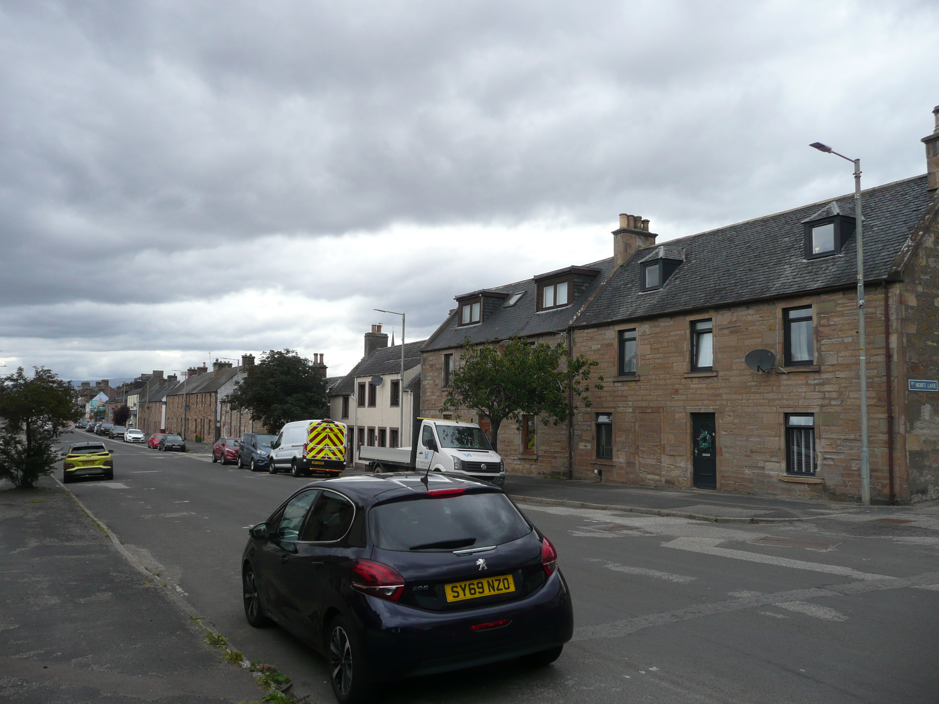
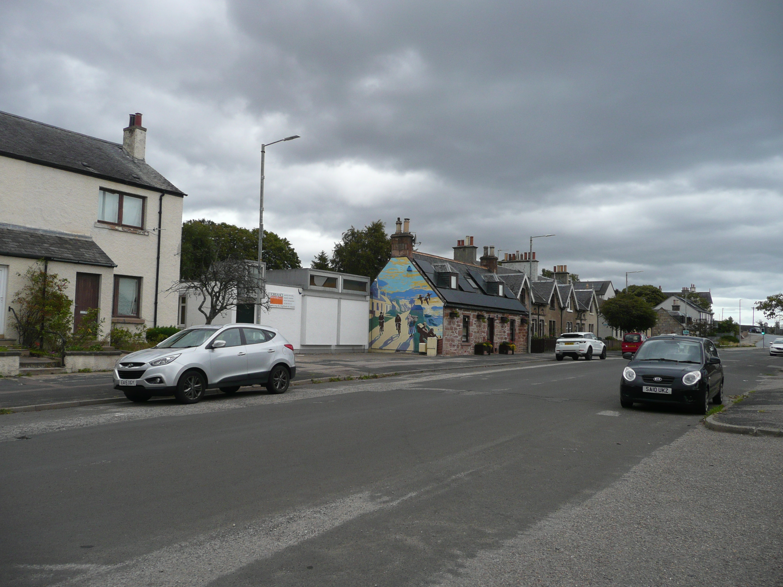
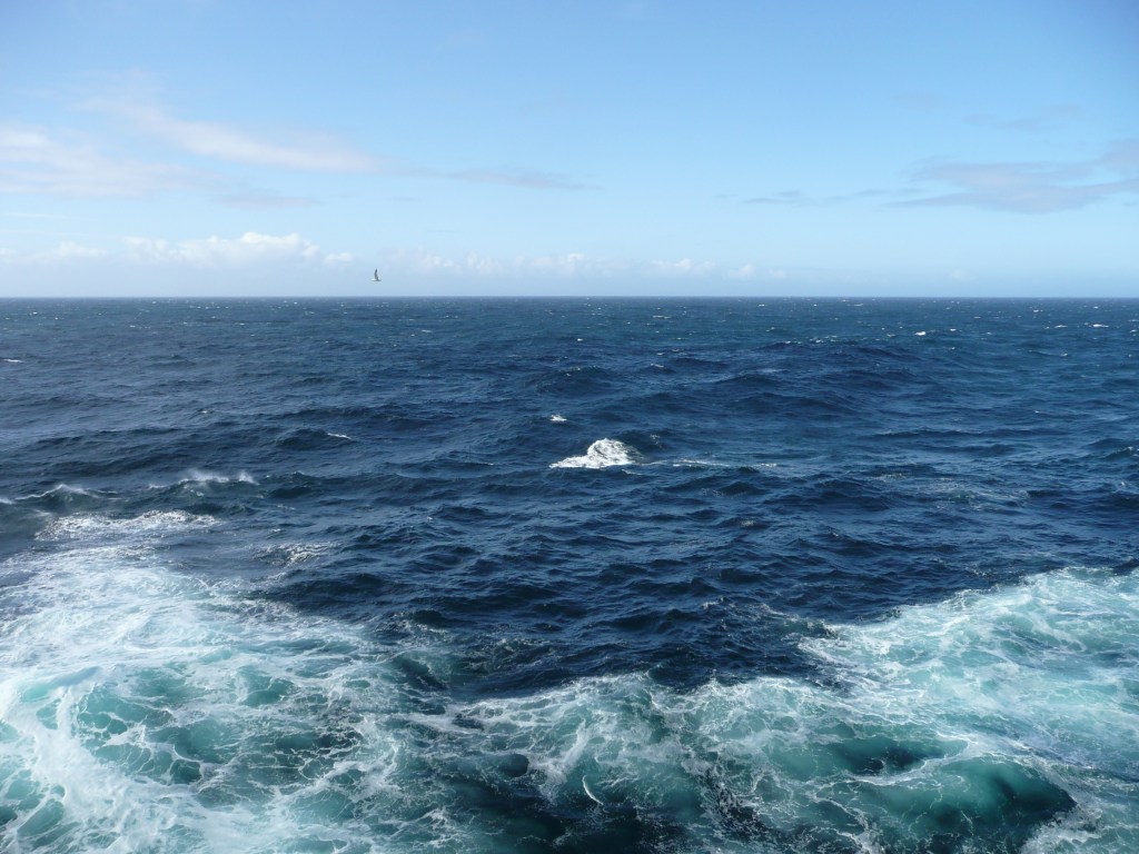
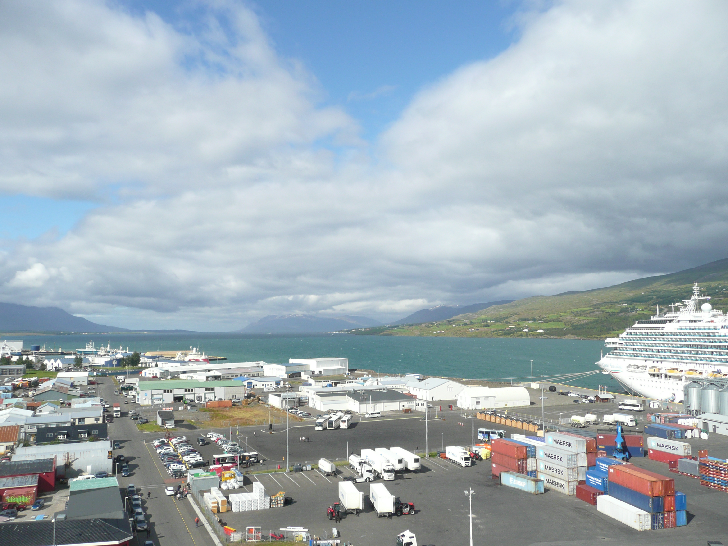
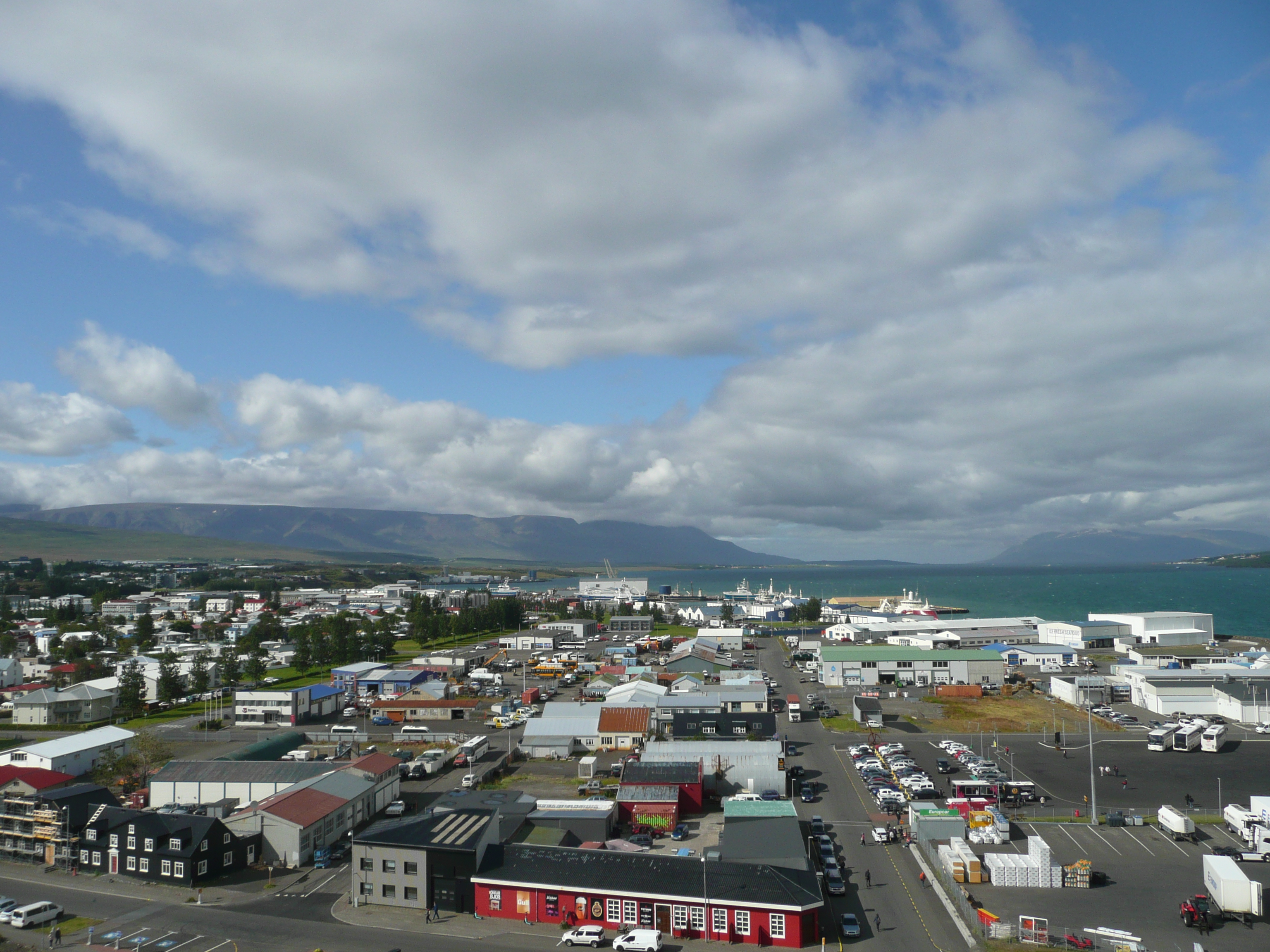
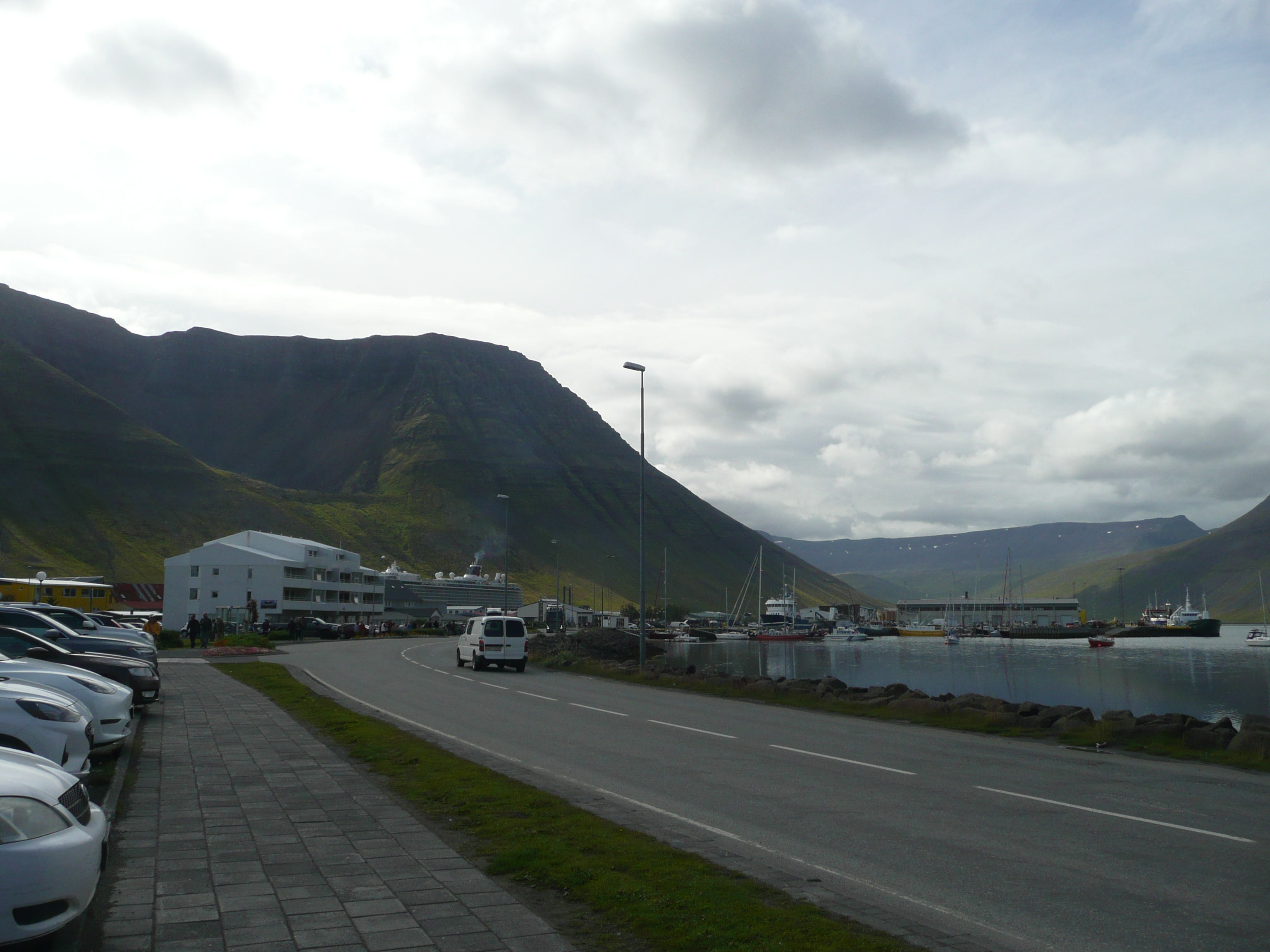
Ostatnie spojrzenie na Loch Ness i wracamy do portu Invergordon bocznymi drogami, wzdłuż wrzosowisk, sosnowych lasów, niewielkich pastwisk i wielkich destylarni. Jutro wypływamy.

One last look at Loch Ness and we return to Invergordon Harbor via back roads, past heathland, pine forests, small pastures, and large distilleries. We sail tomorrow.

Loch Ness

Inverness – Inbhir Nis

Inverness

Przyjechaliśmy do Inverness wcześnie rano, ale miasto już tętniło życiem. Ulice były pełne spacerujących, w katedrze św. Andrzeja trwała msza, właśnie otwierano miejski stadion. Nasz kierowca (w kilcie!) mówi, że Inverness jest jednym z najbezpieczniejszych miast w Szkocji i że wszyscy chcą tu mieszkać, co powoduje ogromny wzrost cen nieruchomości. Opowiada o zamku, pamiętającym czasy Piktów i Makbeta, który tu właśnie miał zabić Duncana. Pytam go o mojego ulubionego pisarza, który mieszkał w Inverness – Alistaira McLean*. Musi sprawdzić w internecie i dziękuje mi za informację 🙂

We arrived in Inverness early in the morning, but the city was already bustling with activity. The streets were full of people strolling, mass was underway in the St. Andrew’s Cathedral, and the municipal stadium was just opening. Our driver (in a kilt!) tells us that Inverness is one of the safest cities in Scotland and that everyone wants to live here, which is causing a huge increase in property prices. He tells us about the castle, which dates back to the Picts and Macbeth, who is said to have killed Duncan here. I ask him about my favorite writer who lived in Inverness, Alistair McLean*. He has to look it up online, and thanks me for the info 🙂

Iverness po gaelicku oznacza „ujście rzeki Ness”. Miasto ma około 45 tys. mieszkańców i jest stolicą Highlands. Rzeka Ness toczy swe wody do zatoki Moray Firth, a słynny zamek jest w remoncie i nigdy nie został odwiedzony przez Elżbietę II.

Iverness is Gaelic for „mouth of the River Ness.” The city has a population of around 45,000 and is the capital of the Scottish Highlands. The River Ness flows into the Moray Firth, and its famous castle is under renovation and has never been visited by Elizabeth II.

Pokrzepieni krwawą historią tego kawałka Szkocji ruszamy dalej na południe drogą A82, żeby zobaczyć coś, co przyniosło Szkocji więcej sławy i pieniędzy, niż Sean Connery.

Buoyed by the bloody history of this part of Scotland, we head further south on the A82 to see something that has brought Scotland more fame and fortune than Sean Connery.

Inverness
  • Alistair McLean – szkocki pisarz, autor wielu powieści sensacyjnych i wojennych (między innymi: Działa Nawarony, Tylko dla orłów, HMS „Ulisses”, Lalka na łańcuchu, Stacja arktyczna „Zebra”).
  • Alistair McLean – Scottish writer, author of many thriller and war novels (including: The Guns of Navarone, Where Eagles Dare, HMS „Ulysses”, A Doll on a Chain, Arctic Station „Zebra”)

Invergordon – Inbhir Ghòrdain

Cromarty Firth

Jesteśmy w zatoce Cromarty Firth – długiej na 30 kilometrów, wąskiej gardzieli płynącej od Morza Północnego do portu w Invergordon, u wschodniego wybrzeża hrabstwa Highland w Szkocji. Każdego roku ponad 30 000 ptaków spędza tu zimę, żywiąc się 21 gatunkami alg i trawy morskiej. Jest domem dla 300 fok pospolitych i grupy 195 delfinów butlonosych. Co roku przypływa tu 10 000 szkockich łososi, które wędrują przez zatokę Cromarty Firth do swoich rodzimych systemów rzecznych w regionie Highlands. Niedługo potem 200 000 ich narybku powraca w dół zatoki, przez cieśninę Sutors, do Morza Północnego. Oprócz łososi dziesiątki gigantycznych wież wiertniczych jest holowanych do portu i tam remontowanych.

We’re in the Cromarty Firth—a 30-kilometer-long, narrow neck of water that runs from the North Sea to the port of Invergordon, on the east coast of the Scottish Highlands. Each year, more than 30,000 birds spend the winter here, feeding on 21 species of algae and seagrass. It’s home to 300 harbor seals and a group of 195 bottlenose dolphins. Every year, 10,000 Scottish salmon arrive here, migrating through the Cromarty Firth to their native river systems in the Highlands. Shortly after, 200,000 of their fry return down the bay, through the Sutors Strait, to the North Sea. In addition to the salmon, dozens of giant oil rigs are towed into port for repairs.

Miasteczko Invergordon to licząca około 4 tysięcy mieszkańców mieścina, słynąca z portu i destylarni, produkującej Single Grain Highland Whisky. Po wyjściu z terenu portu idziemy prawie pustymi ulicami miasteczka w stronę kościelnej wieży.

The town of Invergordon, with a population of around 4,000, is famous for its port and distillery, which produces Single Grain Highland Whisky. After leaving the port area, we walk through the nearly empty streets of the town toward the church tower.

Dochodzimy do głównej ulicy, zwanej chyba w każdym mieście w Wielkiej Brytanii High Street. Tu toczy się życie, mimo świątecznego dnia kilka sklepów jest otwartych, zajętych jest kilka stolików w miejscowej cafe. Wstępuję do sklepu Co-Op, żeby kupić musztardę… angielską. Bałam się, że nie będę rozumieć angielskiego ze szkockim akcentem (miałam kiedyś kumpla Szkota i rzadko rozumiałam, co do mnie mówi, a mówił bez przerwy), ale rozumiem świetnie. Powoli zmierzamy w stronę portu, niewiele już zostało do obejrzenia.

We reach the main street, what every town in Britain calls High Street. Life is bustling here; despite the holiday, a few shops are open, and a few tables are occupied at the local cafe. I stop at the Co-Op to buy some mustard… English. I was worried I wouldn’t understand English with a Scottish accent (I once had a Scottish friend, and I rarely understood what he said, and he spoke constantly), but I understand perfectly. We slowly make our way towards the port; there’s not much left to see.

Wkrótce wyruszymy w głąb Highlands na spotkanie zamków, jezior, wrzosowisk i pewnego potwora.

Soon we will be heading deep into the Highlands to encounter castles, lochs, moors and a certain monster.

Szkocja -Scotland

Płyniemy do Szkocji. Wiecie jak powstała? Na początku czasu Bóg rozmawiał o stworzeniu świata z aniołem Gabrielem. Opowiedział mu o swoich planach dotyczących tego kraju. „Dam Szkocji strzeliste góry i wspaniałe doliny lśniące fioletowym wrzosem. Jelenie będą wędrować po okolicy, orły złote będą krążyć na niebie, łososie będą skakać w krystalicznie czystych rzekach i jeziorach, a otaczające morza będą roić się od ryb. Rolnictwo będzie kwitnąć i nastąpi wspaniałe połączenie wody z jęczmieniem, które będzie znane jako whisky. Węgiel, ropa naftowa i gaz – wszystko tam będzie. Szkoci będą inteligentni, innowacyjni, pracowici i…” „Chwileczkę!” przerwał Gabriel. „Czy nie jesteś odrobinę zbyt hojny dla tych Szkotów?” Ale Wszechmogący odpowiedział: „Niezupełnie. Nie powiedziałem ci jeszcze, kim będą ich sąsiedzi!” W tej historii zawiera się cała Szkockość. A wiecie dlaczego Szkoci noszą kilty? Bo gdy Bóg patrzy w dół, wie, że powinien być dumny, a gdy diabeł patrzy w górę, wie, że powinien się bać. I jeszcze moje ulubione szkockie przysłowie: Wybacz swojemu wrogowi, ale zapamiętaj imię tego drania.

Kocham Szkocję.

North Atlantic

At the begining of time god was discussing the creation of the world with angel Gabriel. He told him of his plans for this country. „I’m going to give Scotland towering mountains and magnificent glens resplendent with purple heather. Red deer will roam the countryside, golden eadles will circle in the skies, salmon will leap in the cristal clear rivers and lochs, and the surrounding seas willteem with fish. Agriculture will flourish and there will be a glourious coming together of water with barley to be known as whisky. coal, oil and gas – all will be there. The Scots will be intelligent, innovative, industrious and…” „Wait a minute!” interrupted Gabriel. „Are you not beeing just a wee bit too generous to these Scots?” But the Almighty replied „Not really. I haven’t told you yet who their neighbours are going to be!”. This story encompasses all that is Scottish.
Why Scots wear kilts? So that when god looks down he knows to be proud and when devil looks up he knows to be afraid.

And my favourite scottish proverb: „Forgive your enemy, but remember the bastard’s name”. I love Scotland.

Sztorm, statkowe życie i stare pieniądze. Storm, ship life and old money

North Atlantic

Sztorm dopadł nas na 61°35′ N 7°14′ W. Pływałam już po morzach i oceanach, ale takich fal jeszcze nie widziałam! Nasz olbrzymi statek wznosi przód na kilka metrów w górę, żeby zaraz spaść w przepaść, kiwając się do tego na boki. Wiecie jak trudno jest w tych warunkach nieść talerz pełen jedzenia? Albo szklankę z piwem? Na wyższych pokładach jest najgorzej, z powodu przechyłów zamknięto basen zewnętrzny. Idziemy do jednego z barów na pogaduszki i tam poznajemy straszliwą prawdę o naszym statku… otóż wszystkie drinki są wliczone w cenę!

A storm hit us at 61°35′ N 7°14′ W. I’ve sailed the seas and oceans before, but I’ve never seen waves like these! Our enormous ship lifts its front several meters into the air, only to plummet into the abyss, rocking side to side. Do you know how difficult it is to carry a plate full of food in these conditions? Or a glass of beer? The upper decks are the worst; the outdoor pool has been closed due to the heel. We go to one of the bars for a chat, and there we learn the terrible truth about our ship… all drinks are included in the price!

Muszę wam opowiedzieć o starych pieniądzach. Kiedyś przez kilka lat mieszkałam i pracowałam w Zjednoczonym Królestwie (i były to najlepsze lata mojego życia). Kiedy w wyniku zaniku mózgu postanowiłam wracać do Polski, zabrałam ciuchy, książki i gotówkę w postaci funtów szterlingów, zwanych dalej GBP. Moja ostatnia wypłata miała zostać przelana na konto w banku i czekać na mnie do skutku. Było to prawie dziesięć lat temu. W tym czasie moje GBP leżały w szufladzie ze skarpetkami i… straciły ważność. W czasie poprzedniego rejsu mieliśmy zawinąć do Portsmouth i tam miałam iść do banku, ale nie popłynęliśmy do Anglii z powodu sztormu. Miałam nadzieję, że tym razem się uda… Ale się nie uda. Trzeba zamówić darmowe Martini Bianco…

I have to tell you about old money. I once lived and worked in the United Kingdom for several years (and those were the best years of my life). When, due to a brain failure, I decided to return to Poland, I took clothes, books, and cash in the form of pounds sterling, hereafter referred to as GBP. My last paycheck was supposed to be deposited into a bank account and wait until I received it. That was almost ten years ago. At that time, my GBP were sitting in my sock drawer… expired. On our previous cruise, we were supposed to dock in Portsmouth, and I was supposed to go to the bank there, but we didn’t make it to England due to a storm. I hoped it would work this time… but it won’t… Must order free Martini Bianco…

A takie rzeczy się dzieją, kiedy jest się miłym dla Stewartów: And this is what happens when you are nice to the Stewarts:

Jeszcze prawie dwa dni podróży przez północny Atlantyk. Płyniemy do kraju, którego narodowym zwierzęciem jest jednorożec, a narodową rośliną – oset. Już wiecie?

Almost two more days of travel across the North Atlantic. We’re sailing to a country whose national animal is the unicorn and whose national plant is the thistle. Do you already know?

Namalowałam / I painted

Ja w łódce i humbak / me in the boat and the humpback whale

Humbaki i banany / Humpback whales and bananas

Dwadzieścia minut po pożegnaniu portu w Akureyri płynęliśmy w stronę ujścia fiordu i nagle dostaliśmy wiadomość, że na bakburcie będzie widać wieloryby!!! Wieloryby, które zawsze chciałam zobaczyć, które były na mojej długiej liście „rzeczy do zobaczenia przed śmiercią”, cudowne, prawie mityczne stworzenia, w obronie których podpisałam tysiące petycji, a nawet napisałam list do prezydenta Obamy. I były! Trzy piękne, wielkie cielska, widziane tylko przez sekundę na powierzchni i nurkujące w głębiny, potem przez chwilę było widać ich białe brzuchy i znów znikały. Humbaki, bo to były humbaki są malutkie. Mogą mieć 17 metrów długości i ważyć do 30 ton. Takie przytulanki…

Twenty minutes after leaving Akureyri Harbor, we were sailing towards the mouth of the fjord when we suddenly received word that whales would be visible on the port side! Whales I’d always wanted to see, whales that had been on my long list of „things to see before I die,” wondrous, almost mythical creatures for which I’d signed thousands of petitions and even written a letter to President Obama. And there they were! Three beautiful, enormous bodies, visible only for a second at the surface and then diving into the depths, then their white bellies were visible for a moment and then they disappeared again. Humpback whales, because they were humpback whales, are tiny. They can be 17 meters long and weigh up to 30 tons. Such cuddly creatures…

Podczas gdy inne wieloryby chcąc się najeść szybko pływają w prostej linii z otwartą buzią, humbaki wypuszczają bąble powietrza, które zamykają ryby i skorupiaki w jednym miejscu. Potem wynurzają się z otwartymi paszczami połykając setki ryb naraz. Widzieliśmy je później jeszcze raz – z trzynastego pokładu wydawały się malutkie. Tym razem było ich osiem i tym razem też nie udało się ich sfotografować.

While other whales swim quickly in a straight line with their mouths open to feed, humpbacks release air bubbles that trap fish and crustaceans in one place. Then they emerge with their jaws open, swallowing hundreds of fish at once. We saw them again later—from deck thirteen, they seemed tiny. This time, there were eight of them, and again, we couldn’t photograph them.

Po wyjściu w fiordu płyniemy na wschód, a póżniej popłyniemy wzdłuż wybrzeża Islandii prosto na południe. Przy okazji chciałabym was zapytać, czy wiecie jaki kraj w Europie uprawia najwięcej bananów? Tak, Hiszpania na Wyspach Kanaryjskich i Francja na Martynice. Ale w Europie (!) najwięcej bananowców uprawia się na Islandii. Na Islandii, dzięki energii geotermalnej rosną też pomidory, papryka i truskawki, maliny, ogórki…

After exiting the fjord, we sail east, and then sail along the coast of Iceland straight south. I’d like to ask you, do you know which country in Europe grows the most bananas? Yes, Spain in the Canary Islands and France in Martinique. But in Europe (!) the largest banana plantation is in Iceland. In Iceland, thanks to geothermal energy, tomatoes, peppers, strawberries, raspberries, cucumbers…

Iceland

Akureyri

Akureyri

Jesteśmy 90 kilometrów na południe od kręgu polarnego, w Akureyri, największym mieście na północy Islandii i trzecim co do wielkości. Jego historia sięga 9 wieku, kiedy Wiking Helgi magri (chudy) Eyvindarson osiedlił się tu wraz z żoną Porunn Hyrna, ale nabrało znaczenia dopiero w XVI wieku, kiedy Duńczycy założyli tu misję handlową. Pochodzą stąd artyści, poeci, pisarze i politycy. Otoczone jest wysokimi na ponad tysiąc metrów granitowymi górami, a wody fiordu nie zamarzają zimą. Ani latem 🙂

We’re 90 kilometers south of the Arctic Circle, in Akureyri, the largest city in northern Iceland and the third largest. Its history dates back to the 9th century, when the Viking Helgi magri (the skinny) Eyvindarson settled here with his wife Porunn Hyrna, but it only gained importance in the 16th century, when the Danes established a trading mission. Artists, poets, writers, and politicians have hailed from here. It’s surrounded by granite mountains over a thousand meters high, and the fjord waters don’t freeze in winter. Or in summer.

Najpierw jedziemy do ogrodu botanicznego (!), który jest najpółnocniejszym ogrodem botanicznym na świecie. I znów muszę was zanudzić historią: w roku 1863, pięćdziesiąt lat przed tym, jak kobiety na Islandii zdobyły prawo do głosowania, w Akureyri mogły brać udział w rządzeniu miastem i zasiadały w radzie municypalnej. W 1909 roku postanowiły ozdobić swoje miasto i założyły ogród botaniczny, w którym dziś jest ponad 7000 gatunków roślin. Ogród można odwiedzać przez cały rok i nie płaci się za wstęp.

First, we head to the Botanical Garden (!), the northernmost botanical garden in the world. And again, I have to bore you with history: in 1863, fifty years before women in Iceland gained the right to vote, women in Akureyri were allowed to participate in city government and served on the municipal council. In 1909, they decided to beautify their city and established a botanical garden, which today houses over 7,000 plant species. The garden can be visited all year round and there is no admission fee.

Akureyri botanical garden

Wracamy do portu, by stamtąd już pieszo iść do miasta, choć transport publiczny jest za darmo. Po lewej mijamy wielki budynek centrum kulturalnego z tęczową flagą (teczowe flagi łopoczą na Islandii nawet przed kościołami) i zanurzamy się w prawie puste ulice.

We return to the port and from there walk back to the city, although public transport is free. On the left, we pass the large cultural center building with a rainbow flag (rainbow flags fly even in front of churches in Iceland) and enter the nearly empty streets.

W Akureyri czerwone światła na ulicach są w kształcie serduszek! / In Akureyri, red street lights are heart-shaped!

Akureyri and Akureyrarkirkja

Elfy – Elves

Z drogi N1 skręciliśmy na wąską, szutrową ścieżynę. Po lewej stronie w głębokim korycie płynie rwąca rzeka, po prawej wznoszą się piekne, zielone wzgórza. Nigdzie nie widać domów, ani tym bardziej ludzi, ale spotykamy innych mieszkańców wyspy – jak zwykle po trzy, mama i dwa jagnięta. Często się zdarza, że wygrzewają się na drogach, a potem gapią się i nie chcą ustąpić.

We turned off the N1 onto a narrow, gravel path. To our left, a rushing river flows in a deep bed, and to our right, beautiful, green hills rise. There are no houses in sight, let alone people, but we do encounter other island inhabitants – the usual three of them, a mother and two lambs. They often bask in the sun on the roads, then stare, refusing to budge.

Zanim dotrzemy na miejsce, opowiem wam o Elfach, powszechnie znanych mieszkańcach Islandii. Ponad połowa Islandczyków wierzy w istnienie elfów, zwanych tutaj Huldufólk, czyli „ukryci ludzie”. Jak wszyscy wiedzą Elfy wyglądają jak ludzie, ale są od nich wyżsi, szczuplejsi i oczywiście ładniejsi. Są Elfy Światła i Elfy Mroczne (czarne) i są lokalnymi bóstwami, które sprawują opiekę nad domostwami i ludźmi. Jedna z legend opisująca pochodzenie Huldufolk głosi, że kiedy diabeł wzniecił bunt w niebie, mieszkańcy, którzy nie byli po jego stronie, ale też nie byli mu przeciwni, zostali zesłani na Ziemię. Zamieszkali w „lasach, wzgórzach i skałach” i „nie mogli mieszkać z innymi ludźmi”. Oczywiście chrześcijanom przeszkadzało to proste przesłanie, więc wymyślili, że elfy są dziećmi Adama i Ewy, które na skutek zaniedbań rodzicielskich zostały ukryte przed bogiem, kiedy ten przyszedł w odwiedziny. Kiedy to odkrył, strasznie się wkurzył i powiedział „„To, co miało być ukryte przede Mną, będzie ukryte także przed ludźmi”. I tak powstali „ukryci ludzie”. Elfy są jednak widziane tu i ówdzie i mają wielki wpływ na życie na Islandii. Jednym z licznych (!) przykładów „elfiej” interwencji wydarzył się w 2013 roku, kiedy wstrzymano proponowaną budowę drogi z powodu protestów zwolenników elfów i grup ekologicznych, które twierdziły, że droga zniszczy siedliska elfów i lokalne wierzenia kulturowe. Jeden z protestujących zainteresował się dużą skałą, która znajdowała się na drodze. Projektanci drogi komentowali później: „Przyjrzeliśmy się skale nie przez pryzmat wiary w elfy, ale przez pryzmat tego, że elfy lub ukryte osoby są częścią naszego dziedzictwa kulturowego. Przyjrzeliśmy się tej dużej formacji skalnej i uznaliśmy, że jest wyjątkowa, i postanowiliśmy, że skoro możemy przenieść [drogę], spróbujemy to zrobić”. I jak nie kochać Islandii.

Before we get on place, I’ll tell you about elves, information about the inhabitants of Iceland. More than half of Icelanders believe in the existence of elves, here called Huldufólk, or „hidden people.” Like everybody know, Elves look like humans, but are taller, slimmer, and, of course, more beautiful. There are Light Elves and Dark (black) Elves, and they take care of homes and people. One legend describing the origin of the Huldufólk says that when the devil incited a rebellion in heaven, the inhabitants, not on his side but not against him, were exiled to Earth. They lived in „forests, hills, and rocks” and „could not live with other people.” Naturally, Christians were bothered by this simple solution, so they invented the idea that elves were the children of Adam and Eve, who, due to parental neglect, were hidden from god when he came to visit. When he discovered it, he became angry and said: „That which had to be hidden from Me, shall also be hidden from man, ” I take the „hidden people” arose. Elves, however, are seen here and there and have a significant impact on life in Iceland. One of the numerous (!) examples of „elven” intervention occurred in 2013, when a proposed road construction was halted due to protests from elf advocates and environmental groups, who claimed the road would destroy elf habitats and local cultural beliefs. One of the protesters took an interest in a large rock that was in the way. The road’s designers later commented, „We looked at the rock not through the prism of belief in elves, but through the prism of elves or hidden people being part of our cultural heritage. We looked at this large rock formation and thought it was unique, and we decided that if we could move [the road], we would try to do it.” And how can you not love Iceland?

Nord of Iceland

Dotarliśmy na miejsce – maleńka osada powstała w XI wieku, przytulona do wzgórza, ze wspaniałym widokiem na fjord. Od XIX wieku była siedzibą wikarego i jego rodziny. Ostatni mieszkańcy wyprowadzili się stąd w 1936 roku i wtedy powstało muzeum. Zobaczcie sami:

We arrived at our destination – a tiny settlement founded in the 11th century, nestled against a hill, with a magnificent view of the fjord. Since the 19th century, it had been the residence of a vicar and his family. The last inhabitants moved out in 1936, and that’s when the museum was established. See for yourself:

Laufas Heritage Site

Domki ukryte we wzgórzu zbudowane są z torfu i kamieni, są połączone labiryntem korytarzy prowadzących od pomieszczeń gospodarczych poprzez sypialnie, kuchnię i spiżarnie, aż do jadalni i salonu, w którym wikary przyjmował gości. W domach są przedmioty codziennego użytku, meble, kompletnie wyposażona kuchnia i jadalnia ze spiżarnią. W pokoju dziecięcym odkrywam szkatułkę wypełnioną zębami zwierząt (ale nie mówcie nikomu, że tam zajrzałam). Łóżka są bardzo krótkie, a w całym domostwie pachnie torfem.

The houses, hidden in the hillside, are built of peat and stone, connected by a maze of corridors leading from utility rooms, through bedrooms, kitchen, and pantry, to the dining room and living room where the vicar received guests. The houses are furnished with everyday objects, furniture, a fully equipped kitchen, and a dining room. In the children’s room I discover a box filled with animal teeth (but don’t tell anyone I looked). The beds are very short, and the entire house smells of peat.

Laufas Heritage Site, Iceland
Laufas Heritage Site

Odkrywam jeszcze domek dla elfów: / I also discover the elf house:

Elf house, Iceland

Islandia – północny wschód Iceland – northeast

Eyjafjörður, Iceland

Rano zacumowaliśmy w głębi najdłuższego (60 km) islandzkiego fjordu Eyjafjörður, a teraz jedziemy drogą N1 na południowy wschód. Droga wiedzie najpierw wzdłuż fiordu, na brzegu wylegują się foki, z gór spływają wody potoków, zamieniające się w wąskie wodospady po dopłynięciu do krawędzi skał. Potem skręcamy w głąb lądu, kolejne zielone góry stopniowo odsłaniają zielone doliny z niewielkimi rzekami i owce pasące się na nieskończonych łąkach… I to był ten moment, ten właśnie moment, w którym zakochałam się w Islandii

Islandia – północny wschód / Iceland – northeast

This morning we docked deep inside Iceland’s longest (60 km) fjord, Eyjafjörður, and now we’re heading southeast on Route 1. The road first follows the fjord, with seals basking on the shore, and streams cascading down from the mountains, transforming into narrow waterfalls as they reach the edge of the cliffs. Then we turn inland, with more green mountains gradually revealing green valleys with small rivers and sheep grazing in endless meadows… And that was the moment, the very moment, that I fell in love with Iceland.

Eyjafjörður, Iceland

Po około 40 kilometrach jesteśmy na miejscu, przy Goðafoss – Wodospadzie Bogów. Według „Księgi Islandczyków” w roku 1000 na Islandii trwał zażarty spór między zwolennikami chrześcijaństwa a tymi, którzy wierzyli w starych, nordyckich bogów. Sprawujący wówczas władzę naczelnik okręgu Þorgeir Ljósvetningagoði Þorkelsson (pogański kapłan) postanowił, że Islandia musi przyjąć wiarę chrześcijańską. Ponoć myślał o tym całą noc i dzień, a potem wrzucił posągi „starych bogów” do wodospadu i tak powstała jego nazwa i… legenda. W tak straszny sposób pozbyto się potężnego Odyna, Thora i Frei.

After about 40 kilometers, we arrive at Goðafoss – the Waterfall of the Gods. According to the „Book of Icelanders,” in the year 1000, a fierce dispute raged in Iceland between supporters of Christianity and those who believed in the old Norse gods. The then-ruling district chief, Þorgeir Ljósvetningagoði Þorkelsson (a pagan priest), decided that Iceland must adopt the Christian faith. He supposedly thought about it all night and day, then threw statues of the „old gods” into the waterfall, thus giving rise to the waterfall’s name and… the legend. In such a terrible way the mighty Odin, Thor and Freya were disposed of.

Goðafoss, Islandia

Wodospad jest częścią rzeki Skjálfandafljót, płynącej przez prawie 180 kilometrów od wielkiego lodowca Vatnajökull, przez pola lawy aż do zatoki Skjálfandi, gdzie uchodzi do Morza Arktycznego. Wodospad ma 30 metrów szerokości i wysokość 12 metrów, ma kształt półkolisty. Droga prowadząca do wodospadu jest wyboista i ma około dwóch kilometrów. No i wieje zimny wiatr.

The waterfall is part of the Skjálfandafljót River, which flows for almost 180 kilometers from the massive Vatnajökull glacier, through lava fields, and finally to Skjálfandi Bay, where it empties into the Arctic Ocean. The waterfall is 30 meters wide and 12 meters high and has a semicircular shape. The road leading to the waterfall is approximately two kilometers long and bumpy. And a cold wind is blowing.

Goðafoss, Iceland 2025

Zmarznięci, ale wypełnieni duchem nordyckich bogów wyruszamy dalej, tym razem na północ. Cold, but filled with the spirit of the Norse gods, we set off further, this time north.

Ísafjörður

Ísafjörður 2025

Ísafjörður to stolica Westfjords, ogromna metropolia z 2 770 mieszkańcami, powstała już w XVI wieku. Otaczają ją zewsząd fiordowe góry, dochodzące do 700 m n.p.m. U ich podnóży rosną lasy – info specjalnie dla tych, którzy myślą, że na Islandii nie ma lasów. Owszem, przez kilka wieków nie było, bo zostały wytrzebione przez pierwzsych mieszkańców na budowy domów i opał. Ale już są i rosną wielkie i zielone 🙂

Ísafjörður is the capital of the Westfjords, a vast metropolis with 2,770 inhabitants, founded in the XVIth century. It is surrounded by fjord mountains, reaching up to 700 meters above sea level. Forests grow at their foot – information especially for those who think there are no forests in Iceland. True, for several centuries there weren’t any, having been cleared by the first inhabitants for building houses and fuel. But now they are, and they are growing large and green.

Our ship in Isafjordur – Nasz statek w Isafjordur

Wyspa powinna szczycić się tym, że na 365 dni w roku ma 65 dni słonecznych. Mamy szczęście – dziś jest jeden z tych dni. Idziemy spacerkiem przez miasto – najpierw widzimy najstarsze budynki – drewniany kościół, drewniana restauracja, gdzie można spróbować zupy rybnej, drewniany budynek muzeum regionalnego i (oczywiście) drewniany baraczek informacji dla turystów, gdzie można kupić wycieczki na oglądanie pingwinów, wielorybów, maskonurów, czy kursy obróbki żelaza.

The island should boast that it has 65 sunny days out of 365 days a year. We’re lucky – today is one of those days. We stroll through the town, first seeing the oldest buildings – a wooden church, a wooden restaurant where you can try fish soup, the wooden building of the regional museum, and (of course) the wooden tourist information hut, where you can book penguin-, whale-, and puffin-watching tours, or ironworking courses.

Dalej jest niewielki port z rybackimi kutrami, a potem ulica się rozdziela. / Further on there is a small port with fishing boats, and then the street splits.

Skręcamy w prawo i odnajdujemy kolejną „tęczową ulicę” / We turn right and find another „rainbow street”.

Jeszcze dwie przecznice i miasto właściwie się kończy. Skręcamy tym razem w lewo (koło pizzerii) i znów jesteśmy nad wodami fiordu. / Two more blocks and the city essentially ends. We turn left this time (near the pizzeria) and find ourselves back at the fjord.

Kilkaset metrów dalej jest stara siedziba duńskiej misji handlowej, obecnie restauracja (zamknięta). Przechodzimy przez budynek na kolejną ulicę, gdzie odnajdujemy śliczne domki / A few hundred meters away is the old Danish Trade Mission headquarters, now a restaurant (closed). We pass through the building onto another street, where we find pretty houses.

Po chwili znów jesteśmy obok muzeum. Obejrzenie miasta w żółwim tempie zajęło nam godzinę. Teraz mamy czas, żeby w drewnianym baraku, spełniającym rolę portowego terminala połączyć się z darmowym wi-fi. Wieczorem ruszamy na wschód i będziemy płynąć wzdłóż równoleżnika 66°33′ N. Ten równoleżnik to koło podbiegunowe.

A moment later, we’re back at the museum. It took us an hour to see the city at a snail’s pace. Now we have time to connect to the free Wi-Fi in the wooden hut that serves as the port terminal. In the evening, we head east, sailing along the parallel of 66°33′ N. This parallel is the Arctic Circle.