Jedną nogą w Ameryce – One foot in America

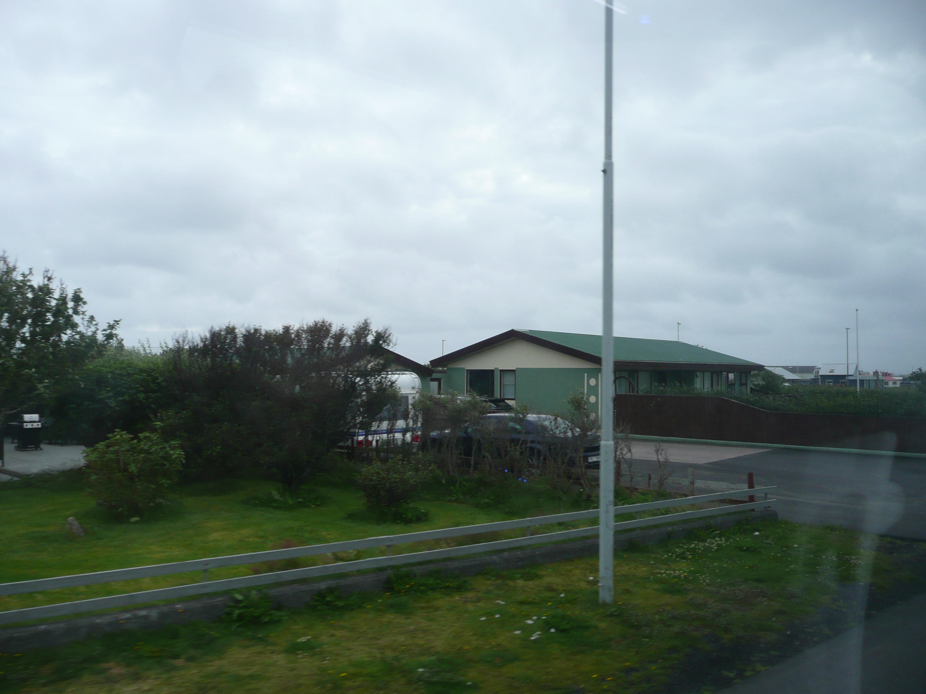
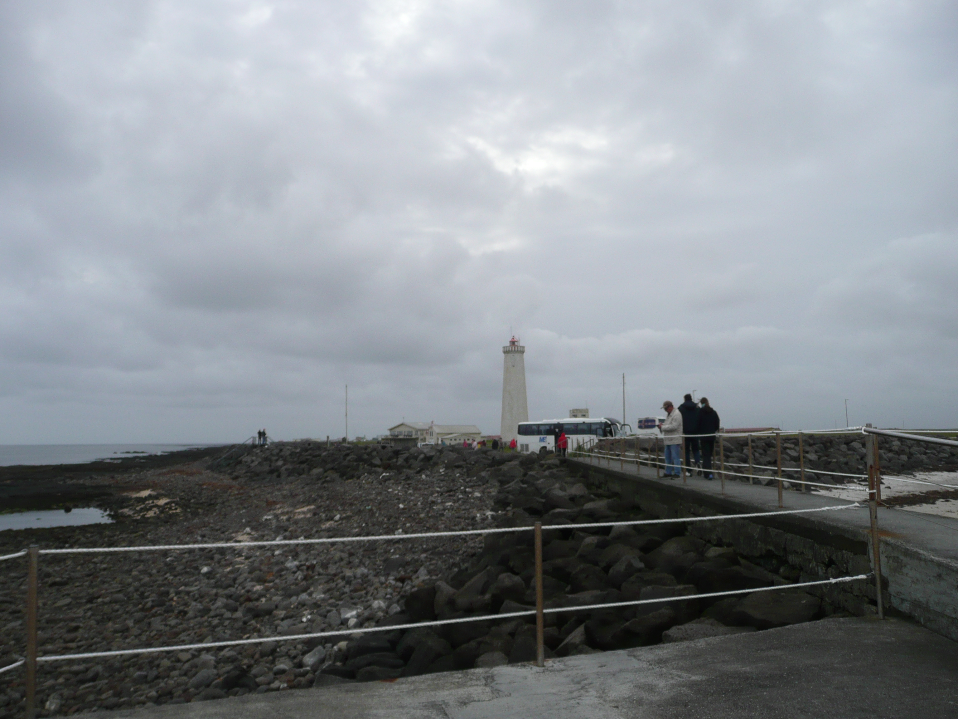
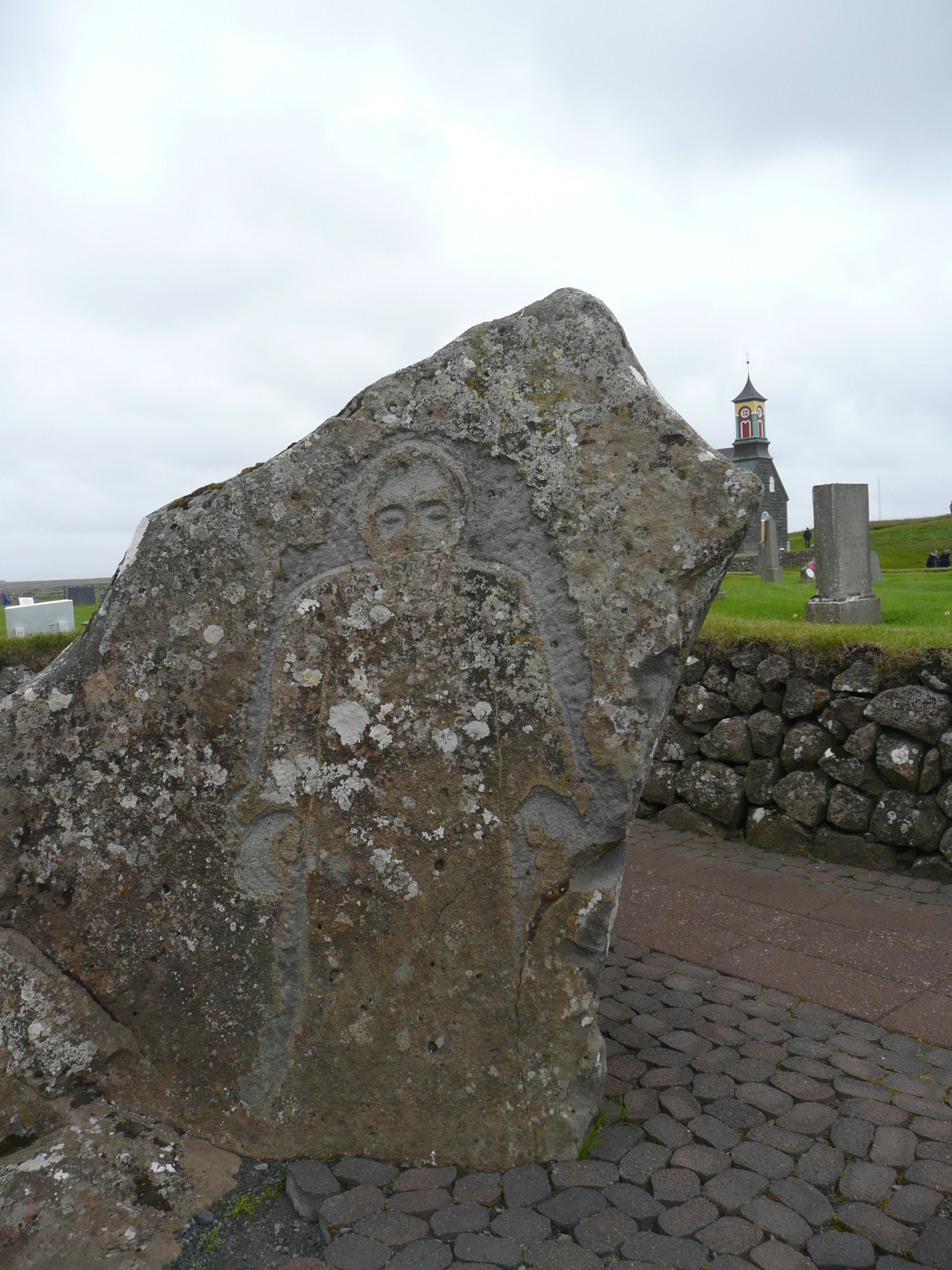
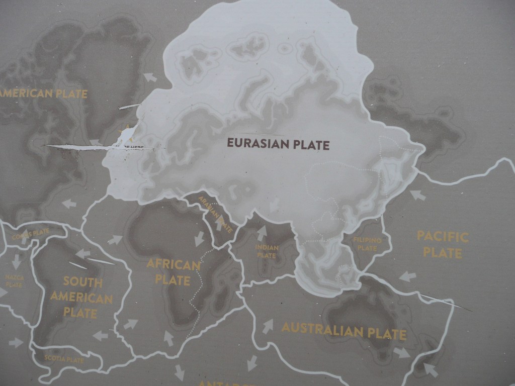
Jak wiecie, Ziemia jest płaska i spoczywa na grzbietach czterech słoni: Berilii, Tubula, Wielkiego T’Phona i Jerakeena, stojących na skorupie A’Tuina, wielkiego żółwia płynącego przez Wszechświat… No dobra, kto zna Świat Dysku, ten wie o co chodzi… Ale serio, to mieszkamy na największej na Ziemi płycie tektonicznej, zwanej płytą euroazjatycką. Żyje na niej 75 procent ludności. Na Atlantyku spotyka się ona z płytą północnoamerykańską, a Islandia leży na styku tych dwóch wielkich, tektonicznych potworów, stąd tak częste trzęsienia ziemi. A teraz wyobraźcie sobie, że jesteście w jedynym miejscu na świecie, gdzie możecie stanąć pomiędzy tymi dwiema płytami!

As you know, the Earth is flat and rests on the backs of four elephants: Berilia, Tubul, Great T’Phon, and Jerakeen, standing on the shell of A’Tuin, a giant turtle swimming through the Universe… Okay, those familiar with Discworld know what I mean… But seriously, we live on the largest tectonic plate on Earth, called the Eurasian Plate. Seventy-five percent of the population lives on it. In the Atlantic, it meets the North American Plate, and Iceland lies at the meeting point of these two tectonic monsters, hence the frequent earthquakes. Now imagine being in the only place in the world where you can stand between these two plates!

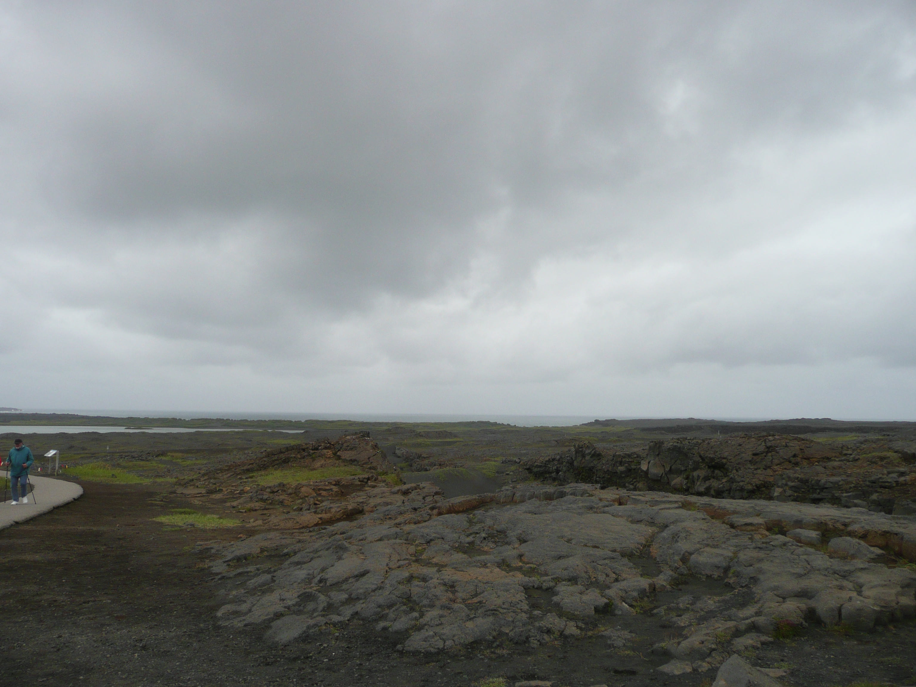
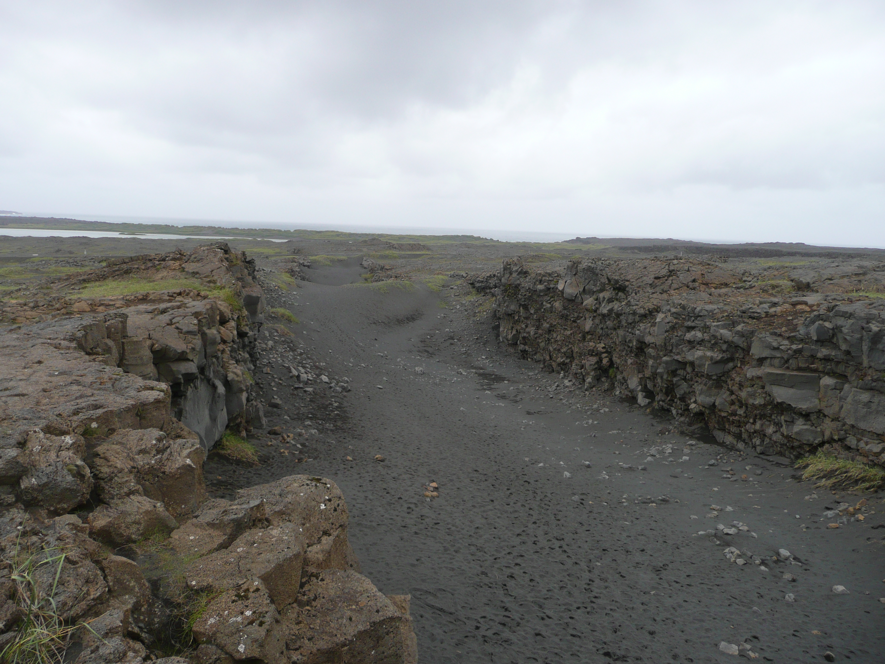
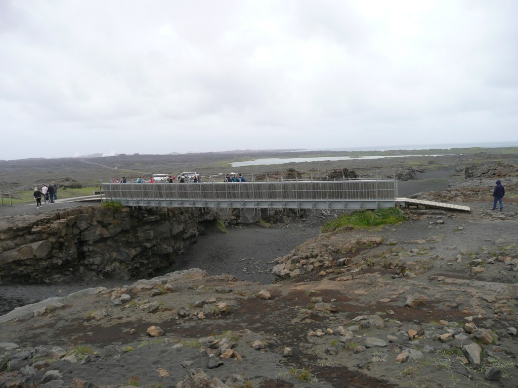
Jesteśmy w Parku Narodowym Þingvellir, gdzie można zobaczyć tzw. ryft oceaniczny na powierzchni, a nie w głębinach… choć w głębinach też można, nurkując w szczelinie Silfra, wypełnionej krystalicznie czystą wodą. Ale można też przejść przez symboliczny Most Między Kontynentami, zwany także Miðlína. Wysłałam Pana i Władcę do Ameryki, skąd zdążył wrócić, zanim odległość między płytami wzrosła o kolejne 2,5 centymetra (bo o tyle oddalają się od siebie rocznie obie płyty).

We’re in Þingvellir National Park, where you can see the so-called ocean rift on the surface, not in the depths… although you can also dive into the depths, diving the Silfra fissure, filled with crystal-clear water. But you can also cross the symbolic Bridge Between the Continents, also known as Miðlína. I sent my Lord and Master to America, from where he returned before the distance between the plates increased by another 2.5 centimeters (the distance the two plates move apart each year).

Pora ruszać dalej, na spotkanie gejzerów. / It’s time to move on, to meet the geysers.

Reykjanes

Wyruszamy wcześnie po wieeelkim śniadaniu (składającym się głównie ze statkowego najpyszniejszego na świecie chleba i serów, których kolekcja jest imponująca i choćby dlatego warto płynąć „moim statkiem”). Jest zimno i pochmurno, ale mamy czapki i zimowe kurtki. Autokar jedzie wzdłuż wybrzeża, mijając niewielkie osiedla parterowych domów rozrzuconych po obu stronach drogi. W oddali widać parę unoszącą się nad słynną „Niebieską Laguną”, a kawałek dalej białe obłoki nad wielką elektrownią geotermalną w Svartsengi.

We set off early after a hearty breakfast (consisting mainly of the ship’s most delicious bread and cheeses the collection of which is impressive and worth sailing on „my ship” for just that reason alone). It’s cold and overcast, but we’ve got hats and winter jackets. The coach travels along the coast, passing small settlements of single-story houses scattered on both sides of the road. In the distance we can see steam rising from the famous „Blue Lagoon”, and a little further white clouds over the large geothermal power plant in Svartsengi.

Jedziemy na półwysep Reykjanes, na południowy zachód od stolicy. Nazwa półwyspu oznacza „dymiący punkt”. Reykjanes jest częścią globalnego parku UNESCO. Krajobraz jest w kolorach ciemnej szarości, przetykanej gdzieniegdzie zielonością mchu, który wyrasta zaraz po tym, jak deszcz ostudza pola lawy… Wszystko co widać wokół to zastygła lawa. Reykjanes doświadcza wiele erupcji wulkanów od 2021 roku. Niemal każda erupcja poprzedzona jest trzęsieniem ziemi, które wstrząsa magmą, wtedy ziemia rozstępuje się jak wrota piekieł, tworzą się szczeliny, niektóre na wiele kilometrów i lawa wydostaje się na powierzchnię, wypływając często przez wiele miesięcy.

We’re heading to the Reykjanes Peninsula, southwest of the capital. The name translates to „smoking point”. Reykjanes is part of a UNESCO global park. The landscape is a dark gray, interspersed with the green of moss that grows immediately after rain cools the lava fields. All you see is solidified lava. Reykjanes has experienced numerous volcanic eruptions since 2021. Almost every eruption is preceded by an earthquake, which shakes the magma, then the ground splits open like a gates of hell, some extending for kilometers, and lava emerges onto the surface, often for months.

Docieramy do starej latarni morskiej Reykjanesviti, zbudowanej w 1878 roku. Osiem lat później została zniszczona przez trzęsienie ziemi. Odbudowano ją dopiero w 1908. Tereny wokół są wielkim żerowiskiem dla morskich ptaków, a zapach gnijących wodorostów zapiera dech…

We reach the old Reykjanesviti Lighthouse, built in 1878. Eight years later, it was destroyed by an earthquake and rebuilt only in 1908. The surrounding area is a great feeding ground for sea birds, and the smell of rotting seaweed is breathtaking…

Jedziemy drogą nr 45 na południe. Jest trochę bardziej zielono, na nielicznych łąkach pasą się konie, nie tylko islandzkie. Ziemia jest poprzecinana rozpadlinami i bazaltowymi skałami. Wśród skał i wąwozów widać białe owce, zwykle po trzy – mama i dwoje jagniąt. Zaglądamy do niewielkiego kościoła na wzgórzu, a potem skręcamy na północny wschód…

We head south on Route 45. It’s a bit greener, with horses grazing in the few meadows, not just Icelandic ones. The land is crisscrossed with clefts and basalt rocks. Among the rocks and ravines, we see white sheep, usually three in a row—a mother and two lambs. We visit a small church on a hill, then turn northeast…

Islandia – Iceland

Islandia – Iceland

Przepłynęliśmy 3060 kilometrów i jesteśmy na południowo-zachodnim krańcu Islandii. Jest dosyć ciepło, około 14 stopni i nie pada. Słońce wzeszło o 4:27, zajdzie o 22:13, czyli dzień potrwa około osiemnastu godzin. Przybyliśmy do kraju, który ma najstarszy parlament na świecie (założony w 930 roku), gdzie mieszkańcy nie mają nazwisk, gdzie przestępczość jest tak niska, że policja nie nosi broni, gdzie nie ma kolei i komarów (ale są inne stwory, które je zastępują), gdzie czyta się i kupuje najwięcej książek na świecie, a na każdego mieszkańca przypadają trzy owce… Poza tym jest tu około 1000 wodospadów, a ich liczba ciągle rośnie, nie ma żadnego McDonalda, a największą mniejszością są Polacy.

We’ve sailed 3,060 kilometers and are at the southwestern end of Iceland. It’s quite warm, around 14 degrees Celsius, and it’s not raining. The sun rose at 4:27 a.m. and will set at 10:13 p.m., meaning the day will last about eighteen hours. We’ve arrived in a country with the oldest parliament in the world (founded in 930 AD), where residents don’t have surnames, where crime is so low that police don’t carry weapons, where there are no railways or mosquitoes (but other creatures take their place), where the world’s most books are read and purchased, and where there are three sheep for every resident… Besides that, there are about 1,000 waterfalls and their number is constantly growing, there’s no McDonald’s, and the largest minority are Poles.

Islandia – Iceland

Islandia to największa wulkaniczna wyspa na świecie. Wulkany są ciągle aktywne, a dodatkowo wyspa leży na styku dwóch wielkich płyt tektonicznych… Dzięki tej aktywności, Islandczycy mają darmowe zasilanie odnawialną energią wszystkiego – ogrzewania domów, basenów a nawet chodników. Islandia wytwarza ponad 99% energii elektrycznej ze źródeł odnawialnych, a mianowicie z hydroenergii (około 80%) i geotermii ( około 20%).

Iceland is the largest volcanic island in the world. The volcanoes are constantly active, and the island lies at the junction of two large tectonic plates. Thanks to this activity, Icelanders have free renewable energy for everything – heating their homes, swimming pools, and even sidewalks. Iceland generates over 99% of its electricity from renewable sources, namely hydropower (approximately 80%) and geothermal energy (approximately 20%).

Islandia – Iceland

Co by wam jeszcze o Islandii powiedzieć? Język islandzki jest najstarszym używanym językiem w Europie. Klimat, mimo położenia jest łagodny i wcale nie jest przeraźliwie zimno. Temperatura właściwie nie spada poniżej minus dziesięciu stopni, a często oscyluje wokół zera. Większym problemem są wiatry, wiejące często z prędkością ponad 100 km/h, zdolne przewrócić samochód. Poza tym Islandczycy nie mają armii, mieli prohibicję do 1989 roku, a trzy główne stanowiska w państwie – prezydenta, premiera i przywódcy kościoła – zajmują kobiety!

What else can I tell you about Iceland? Icelandic is the oldest spoken language in Europe. Despite its location, the climate is mild and not terribly cold. Temperatures rarely drop below minus ten degrees Celsius, often hovering around freezing. A bigger problem are the winds, which often blow at speeds over 100 km/h, capable of flipping a car. Besides, Icelanders have no army; they had prohibition until 1989, and the three main positions in the country – president, prime minister, and church leader — are held by women!

No to wyruszamy! Well, let’s go!